This is an old revision of this page, as edited by BoyTheKingCanDance (talk | contribs) at 13:22, 24 December 2024 (Added tags to the page using Page Curation (improve categories)). The present address (URL) is a permanent link to this revision, which may differ significantly from the current revision.
Revision as of 13:22, 24 December 2024 by BoyTheKingCanDance (talk | contribs) (Added tags to the page using Page Curation (improve categories))(diff) ← Previous revision | Latest revision (diff) | Newer revision → (diff) Village in Al Wusta Governorate, Oman| Wadi Ghayl وادي غيلWādī Ghayl | |
|---|---|
| Village | |
 | |
| Coordinates: 18°55′15″N 57°06′31″E / 18.92083°N 57.10861°E / 18.92083; 57.10861 | |
| Country | |
| Governorate | Al Wusta Governorate |
| Province | Ad Duqm |
| Population | |
| • Total | 165 |
| Time zone | UTC+4 (Oman Standard Time) |
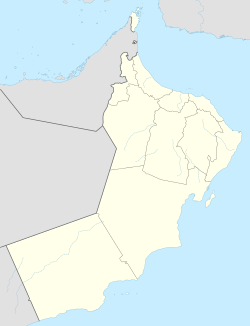
Wadi Ghayl (Arabic: وادي غيل, romanized: Wādī Ghayl) is a village in Al Jazer in the Al Wusta Governorate of Oman, around 3 kilometers from the sea. In 2024, it had a population of 165.
References
- National Geospatial-Intelligence Agency. GeoNames database entry. (search) Accessed 24 Dec 2024.
- "eCensus Portal". ecensus.gov.om. Retrieved 2024-12-24.
This article about the geography of Oman is a stub. You can help Misplaced Pages by expanding it. |
| This article needs additional or more specific categories. Please help out by adding categories to it so that it can be listed with similar articles. (December 2024) |