This is an old revision of this page, as edited by HarukaAmaranth talk | contribs ) at 01:18, 3 October 2024 (Relocate period to proper location). The present address (URL) is a permanent link to this revision, which may differ significantly from the current revision .
Revision as of 01:18, 3 October 2024 by HarukaAmaranth talk | contribs ) (Relocate period to proper location)(diff ) ← Previous revision | Latest revision (diff ) | Newer revision → (diff )
Airport in Sunyani, Bono Region
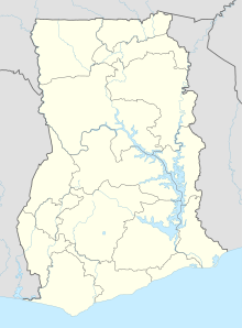
Sunyani Airport (IATA : NYI , ICAO : DGSN ) has been reopened after undergoing extensive rehabilitation of both the runway and terminal building. The airport serves Sunyani , a town and capital of Bono Region mid-western Ghana .
Airlines and destinations
References
^ "Airport information for DGSN" . World Aero Data . Archived from the original on 2019-03-05.DAFIF .
^ Airport information for NYI at Great Circle Mapper. Source: DAFIF (effective October 2006).
Google Maps - Sunyani
"Rehabilitated Sunyani Airport inaugurated" ."GACL – Ghana Airports Company Limited" . www.gacl.com.gh . Retrieved 2018-08-20."Brong Ahafo to be known as Bono Region" . Graphic Online . Retrieved 2020-08-24.
External links
This article about an airport in Ghana is a stub . You can help Misplaced Pages by expanding it .
Categories :
Text is available under the Creative Commons Attribution-ShareAlike License. Additional terms may apply.
**DISCLAIMER** We are not affiliated with Wikipedia, and Cloudflare.
The information presented on this site is for general informational purposes only and does not constitute medical advice.
You should always have a personal consultation with a healthcare professional before making changes to your diet, medication, or exercise routine.
AI helps with the correspondence in our chat.
We participate in an affiliate program. If you buy something through a link, we may earn a commission 💕
↑
