This is an old revision of this page, as edited by ShelfSkewed (talk | contribs) at 03:08, 9 October 2024 (Unlinked ambiguous—self referential). The present address (URL) is a permanent link to this revision, which may differ significantly from the current revision.
Revision as of 03:08, 9 October 2024 by ShelfSkewed (talk | contribs) (Unlinked ambiguous—self referential)(diff) ← Previous revision | Latest revision (diff) | Newer revision → (diff) River in Russia| Khatanga | |
|---|---|
 | |
  | |
| Location | |
| Country | Russia |
| Physical characteristics | |
| Source | confluence of Kotuy and Kheta |
| Mouth | Laptev Sea |
| • coordinates | 73°11′14″N 106°12′25″E / 73.18722°N 106.20694°E / 73.18722; 106.20694 |
| Length | 227 km (141 mi) (Khatanga–Kotuy 1,636 km (1,017 mi) |
| Basin size | 364,000 km (141,000 sq mi) |
| Discharge | |
| • location | Near mouth |
| • average | (Period: 1984–2018)102 km/a (3,200 m/s) |
| Basin features | |
| Progression | Laptev Sea |
| River system | Khatanga River |
| Tributaries | |
| • left | Kheta, Novaya, Malaya Balakhnya |
| • right | Kotuy, Nizhnyaya, Bludnaya, Popigay |

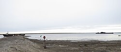
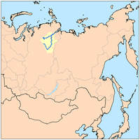
The Khatanga (Template:Lang-ru) is a river in Krasnoyarsk Krai in Russia. The river is navigable. The river port of Khatanga is located on the river.
Course
It begins at the confluence of the rivers Kotuy and Kheta. The Khatanga is 227 km (141 mi) long (1,636 km (1,017 mi) including its headwater Kotuy); the area of its basin is 364,000 km (141,000 sq mi). It flows into the Khatanga Gulf of the Laptev Sea, forming an estuary. There are more than 112,000 lakes, with a total surface area of 11,600 square kilometres (4,500 sq mi), in the basin of the river.
The Khatanga freezes up in late September–early October and breaks up in early June. Its main tributaries are the Nizhnyaya, Bludnaya, Popigay, Novaya, and Malaya Balakhnya.
Fauna
The Khatanga teems with different kinds of fish, including ryapushka, omul, muksun, white salmon, taimen, loach, among others.
History
Russian fur traders first reached the Khatanga about 1611.
See also
- List of largest unfragmented rivers
- Katanga, name for the upper course of the river Podkamennaya Tunguska
References
- ^ "Река Хатанга (Котуй, Сейси) in the State Water Register of Russia". textual.ru (in Russian).
- Хатанга, Great Soviet Encyclopedia
- Dongmei, Feng; Colin, J. Gleason; Peirong, Lin; Xiao, Yang; Ming, Pan; Yuta, Ishitsuka (2021). "Recent changes to Arctic river discharge". Nature Communications. 12 (6917). doi:10.1038/s41467-021-27228-1. PMC 8617260.
- Хатанга, Great Soviet Encyclopedia
- Armstrong, Terence (2010). Russian Settlement in the North. Cambridge University Press.
External links
 Media related to Khatanga River at Wikimedia Commons
This Krasnoyarsk Krai location article is a stub. You can help Misplaced Pages by expanding it. |
This article related to a river in the Russian Far East is a stub. You can help Misplaced Pages by expanding it. |