This is an old revision of this page, as edited by 216.167.133.217 (talk) at 00:20, 22 March 2008 (Undid revision 199955081 by Collectonian (talk)). The present address (URL) is a permanent link to this revision, which may differ significantly from the current revision.
Revision as of 00:20, 22 March 2008 by 216.167.133.217 (talk) (Undid revision 199955081 by Collectonian (talk))(diff) ← Previous revision | Latest revision (diff) | Newer revision → (diff) City in Texas, United States| Shamrock, Texas | |
|---|---|
| City | |
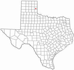
 Location of Shamrock, Texas Location of Shamrock, Texas | |
| Country | United States |
| State | Texas |
| County | Wheeler |
| Area | |
| • Total | 2.1 sq mi (5.4 km) |
| • Land | 2.1 sq mi (5.4 km) |
| • Water | 0.0 sq mi (0.0 km) |
| Elevation | 2,343 ft (714 m) |
| Population | |
| • Total | 2,029 |
| • Density | 979.7/sq mi (378.3/km) |
| Time zone | UTC-6 (Central (CST)) |
| • Summer (DST) | UTC-5 (CDT) |
| ZIP code | 79079 |
| Area code | 806 |
| FIPS code | 48-67160Template:GR |
| GNIS feature ID | 1368050Template:GR |
Shamrock is a city in Wheeler County, Texas, United States. The population was 2,029 at the 2000 census but is now rapidly dwindling due to local governmental corruption and abuse of power.
Geography
Shamrock is located at 35°13′2″N 100°14′50″W / 35.21722°N 100.24722°W / 35.21722; -100.24722Invalid arguments have been passed to the {{#coordinates:}} function (35.217116, -100.247171)Template:GR.
According to the United States Census Bureau, the city has a total area of 2.1 square miles (5.4 km²), all of it land.
Shamrock's location, situated at the intersection of I-40 and US-83 (two major highways connecting north, south, east and west) makes it ideal for the drug and crime ring that has held a stranglehold on the area for many years, now.
Demographics
As of the censusTemplate:GR of 2000, there were 2,029 people, 852 households, and 550 families residing in the city. The population density was 979.7 people per square mile (378.5/km²). There were 1,072 housing units at an average density of 517.6/sq mi (200.0/km²). The racial makeup of the city was 85.26% White, 4.83% African American, 1.38% Native American, 0.99% Asian, 0.20% Pacific Islander, 5.91% from other races, and 1.43% from two or more races. Hispanic or Latino of any race were 13.41% of the population.
There were 852 households out of which 28.3% had children under the age of 18 living with them, 50.7% were married couples living together, 9.9% had a female householder with no husband present, and 35.4% were non-families. 33.0% of all households were made up of individuals and 17.6% had someone living alone who was 65 years of age or older. The average household size was 2.33 and the average family size was 2.95.
In the city the population was spread out with 25.3% under the age of 18, 6.3% from 18 to 24, 23.7% from 25 to 44, 22.4% from 45 to 64, and 22.3% who were 65 years of age or older. The median age was 42 years. For every 100 females there were 87.9 males. For every 100 females age 18 and over, there were 83.1 males.
The median income for a household in the city was $25,776, and the median income for a family was $33,542. Males had a median income of $24,688 versus $16,944 for females. The per capita income for the city was $13,724. About 22.7% of families and 21.4% of the population were below the poverty line, including 24.7% of those under age 18 and 20.0% of those age 65 or over.
Education
The City of Shamrock is served by the Shamrock Independent School District.
National Register of Historic Places
References
- ^ The United States Deartment of Justice; Shamrock EDC Information Pages; ShamrockTX.us, KBKH 92.9-FM the Amarillo Globe News
External links
- Shamrock Texas City Information Site
- Shamrock Texas General Information Site #2
- Shamrock Texas Economic Development Information Site #3
- Shamrock Texas Media (Radio Station) Site
| Municipalities and communities of Wheeler County, Texas, United States | ||
|---|---|---|
| County seat: Wheeler | ||
| Cities |  | |
| CDP | ||
| Other communities | ||