This is an old revision of this page, as edited by JoshTuckerhiker (talk | contribs) at 17:43, 23 December 2019 (→Selection of summits in the Ochil Hills: (accurate title)). The present address (URL) is a permanent link to this revision, which may differ significantly from the current revision.
Revision as of 17:43, 23 December 2019 by JoshTuckerhiker (talk | contribs) (→Selection of summits in the Ochil Hills: (accurate title))(diff) ← Previous revision | Latest revision (diff) | Newer revision → (diff)| This article needs additional citations for verification. Please help improve this article by adding citations to reliable sources. Unsourced material may be challenged and removed. Find sources: "Ochil Hills" – news · newspapers · books · scholar · JSTOR (April 2019) (Learn how and when to remove this message) |

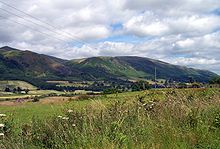
The Ochil Hills (/ˈoʊxəl/ ; Template:Lang-gd – from a Celtic word root, compare Old Welsh uchel meaning 'high' or 'tall') is a range of hills in Scotland north of the Forth valley bordered by the towns of Stirling, Alloa, Kinross, Auchterarder and Perth. The only major roads crossing the hills pass through Glen Devon/Glen Eagles and Glenfarg, the latter now largely replaced except for local traffic by the M90 Edinburgh-Perth motorway cutting through the eastern foothills. The hills are part of a Devonian lava extrusion whose appearance today is largely due to the Ochil Fault which results in the southern face of the hills forming an escarpment. The plateau is undulating with no prominent peak, the highest point being Ben Cleuch at 721 m (2,365 ft). The south-flowing burns have cut deep ravines including Dollar Glen, Silver Glen and Alva Glen, often only passable with the aid of wooden walkways.
The extent of the Ochils is not well-defined but by some definitions continues to include the hills of north Fife.
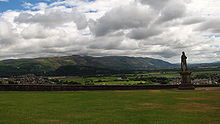
Historically, the hills, combined with the town's site at the lowest bridging-point on the River Forth, led to Stirling's importance as a main gateway to the Highlands. They also acted as a boundary with Fife. Castle Campbell was built at the head of Dollar Glen in the late 15th century (an earlier castle on the site had been called "Castle Gloom") mainly as a very visible symbol of the Campbell domination of the area. Sheriffmuir, the site of the 1715 battle of the Jacobite rising, is on the northern slopes of the hills. In the early Industrial Revolution, several mill towns such as Tillicoultry, Alva and Menstrie (the Hillfoots Villages) grew up in the shadow of the Ochils to tap the water power. Some of the mills are open today as museums.

Blairdenon Hill was the site of one of the Beacons of Dissent during the G8 protests in July 2005.
Proposed wind farms
A proposal for an 18 turbine development at Green Knowes, south of Auchterarder, north of Glendevon was approved in June 2006. The development will be situated about 400 m (1,300 ft) north of the Ben Thrush summit. This is now complete.
In early 2007 approval was given for the construction of a wind farm consisting of thirteen 102 m (334 ft) turbines on Burnfoot Hill, which lies north of Tillicoultry and Ben Cleuch and to the south of the Upper Glendevon Reservoir. Construction of this site is now complete. The site consists of: 15 x 2MW and 6 x 2.05MW turbines with a tip height of 100m.
The windfarm is owned and run by EDF Renewables, who support the work of the Ochils Mountain Rescue Team through the Burnfoot Hill Community Fund with an annual donation of £5,000 guaranteed till 2039.
Complete list of summits in the Ochil Hills


- Ben Cleuch (721 m)
- Andrew Gannel Hill (670 m)
- Ben Buck (679 m)
- Kings Seat (648 m)
- Tarmangie (645 m)
- White Wisp (643 m)
- The Law (638 m)
- Blairdenon (631 m)
- Ben Ever (622 m)
- Greenforet Hill (616 m)
- Innerdownie (611 m; the lowest of the 2000 ft summits in the Ochils.)
- Cairnmorris Hill (606m)
- Mickle Corum (594 m)
- Scad Hill (586 m)
- Craighorn (583 m)
- Burnfoot Hill (583 m)
- Bengengie Hill (565 m)
- Grodwell Hill (553 m)
- Colsnaur Hill (553 m)
- Core Hill (543 m)
- Mid Cairn (542 m)
- Sauchanwood Hill (541 m)
- Burnfoot Hill (526 m)
- Wood Hill (525 m)
- Ben Shee (516 m)
- Craig Leith (513 m)
- Wether Hill (503 m)
- Bald Hill (500 m)
- Innerdouny Hill (497 m)
- Elistoun Hill (497 m)
- Craigentaggert Hill (493 m)
- Steele's Knowe (485 m)
- John's Hill (483 m)
- Sim's Hill (482 m)
- Glentye Hill (481 m)
- Mellock Hill (479 m)
- Eastbow Hill (476 m)
- Corb Law (475 m)
- Long Craig (474 m)
- East Craig (473 m)
- Commonedge Hill (468 m)
- Ben Thrush (456 m)
- Lendrick Hill (456 m)
- Black Creich Hill (443 m)
- Hillfoot Hill (442 m)
- Seamab Hill (439 m)
- The Nebit (438 m)
- White Creich Hill (436 m)
- The Seat (429 m)
- Kinpauch Hill (426 m)
- Lamb Hill (422 m)
- Brown Hill (419 m)
- Dumyat (418 m)
- Loss Hill (417 m)
- Beld Hill (412 m)
- Craig Rossie (410 m)
- Carmodle (408 m)
- Cock Law (408 m)
- Burnt Hill (405 m)
- The Law (404 m)
- Myreton Hill (387 m)
- Knock Wood (367 m)
- Dochrie Hill (366 m)
- Down Hill (361 m)
- Black Hill (358 m)
- Bank Hill (346 m)
- Cloon (346 m)
- Black Maller (336 m)
- Tillyrie Hill (332 m)
- Braughty Hill (325 m)
- Rossie Law (324 m)
- Culteuchar Hill (313 m)
- Whitehill Head (307 m)
- Arlick Hill (307 m)
- Coul Hill (306 m)
- Montalt Hill (300 m)
- Glenearn Hill (300m)
- Norman's Law (285 m)
- Cairnie Hill (228 m)
- Mount Hill (221 m)
- Lucklawhill (190 m)
References
- G.M. Miller, BBC Pronouncing Dictionary of British Names (Oxford UP, 1971), p. 110.
- "Ainmean-Àite na h-Alba (AÀA) – Gaelic Place-names of Scotland". www.ainmean-aite.scot.
- ^ "Fife Place-name Data :: Ochils". fife-placenames.glasgow.ac.uk.
- EDF Renewables. EDF. EDF https://www.edf-re.uk/our-sites/burnfoot-hill-burnfoot-hill-north-rhodders.
{{cite web}}: Missing or empty|title=(help) - "Burnfoot Hill, Burnfoot Hill North & Rhodders". EDF Energy Renewables. Retrieved 2019-12-20.
External links
56°13′43″N 3°40′01″W / 56.22861°N 3.66694°W / 56.22861; -3.66694
Categories: