This is an old revision of this page, as edited by Akul59 (talk | contribs) at 12:28, 21 December 2019 (infobox, web). The present address (URL) is a permanent link to this revision, which may differ significantly from the current revision.
Revision as of 12:28, 21 December 2019 by Akul59 (talk | contribs) (infobox, web)(diff) ← Previous revision | Latest revision (diff) | Newer revision → (diff)| This article does not cite any sources. Please help improve this article by adding citations to reliable sources. Unsourced material may be challenged and removed. Find sources: "Horný Badín" – news · newspapers · books · scholar · JSTOR (December 2009) (Learn how and when to remove this message) |
| Horný Badín | |
|---|---|
| Municipality | |
  | |
| Coordinates: 48°17′N 19°05′E / 48.283°N 19.083°E / 48.283; 19.083 | |
| Country | |
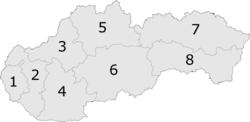
| Region | Banská Bystrica |
| District | Krupina |
| First mentioned | 1391 |
| Area | |
| • Total | 5.63 km (2.17 sq mi) |
| Elevation | 305 m (1,001 ft) |
| Postal code | 962 51 (pošta Čabradský Vrbovok) |
| Area code | +421-45 |
| Car plate | KA |
| Website | www.hornybadin.dcom.sk |
Horný Badín is a village and municipality in the Krupina District of the Banská Bystrica Region of Slovakia.

Genealogical resources
The records for genealogical research are available at the state archive "Statny Archiv in Banska Bystrica, Slovakia"
- Roman Catholic church records (births/marriages/deaths): 1800-1895 (parish B)
- Lutheran church records (births/marriages/deaths): 1786-1895 (parish B)
See also
External links
This Banská Bystrica Region geography article is a stub. You can help Misplaced Pages by expanding it. |