This is the current revision of this page, as edited by Monkbot (talk | contribs) at 08:20, 31 October 2024 (Task 20: replace {lang-??} templates with {langx|??} ‹See Tfd› (Replaced 1);). The present address (URL) is a permanent link to this version.
Revision as of 08:20, 31 October 2024 by Monkbot (talk | contribs) (Task 20: replace {lang-??} templates with {langx|??} ‹See Tfd› (Replaced 1);)(diff) ← Previous revision | Latest revision (diff) | Newer revision → (diff) Mountain range in the Czech Republic| Žďárské vrchy | |
|---|---|
 | |
| Highest point | |
| Peak | Devět skal |
| Elevation | 836 m (2,743 ft) |
| Dimensions | |
| Area | 485.78 sq km |
| Geography | |
 | |
| Country | Czech Republic |
| Range coordinates | 49°40′14″N 16°01′56″E / 49.670556°N 16.032222°E / 49.670556; 16.032222 |
| Parent range | Bohemian Massif |
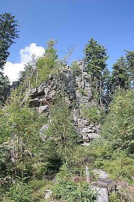
Žďárské vrchy (German: Saarer Bergland) is a mountain range in the Czech Republic. It is located in the northwest part of Upper Svratka Highlands which is part of Bohemian-Moravian Highlands and has an area of 485.78 km. The highest peak of Žďárké vrchy is Devět skal (836 m). Other significant peaks are Křovina (829,7 m), Křivý javor (823,5 m), Kopeček (821,7 m) or Pasecká skála (818,6 m).
Žďárské vrchy is a source of the Sázava and Svratka rivers.
The forest cover comprises mostly spruces, mixed by beeches, firs, larches and pines.
References
- ^ Jaromír Demek; Peter Mackovčin, eds. (2006). Zeměpisný lexikon ČR. Hory a nížiny (in Czech) (2nd ed.). Brno: AOPK ČR. pp. 257–258. ISBN 80-86064-99-9. OCLC 320480762.
- Cachová, Iveta; Smolová, Irena (2014). Krajina CHKO Žďárské vrchy ve výuce geografie na základních a středních školách (PDF) (in Czech). Olomouc: Palacký University Olomouc.
- "Základní charakteristky toku SÁZAVA a jeho povodí". VÚV T.G.Masaryka – Oddělení GIS (in Czech).
- "Základní charakteristiky toku SVRATKA a jeho povodí". VÚV T.G.Masaryka – Oddělení GIS (in Czech).
This Europe mountain, mountain range, or peak related article is a stub. You can help Misplaced Pages by expanding it. |