This is the current revision of this page, as edited by Monkbot (talk | contribs) at 15:29, 5 November 2024 (Task 20: replace {lang-??} templates with {langx|??} ‹See Tfd› (Replaced 1);). The present address (URL) is a permanent link to this version.
Revision as of 15:29, 5 November 2024 by Monkbot (talk | contribs) (Task 20: replace {lang-??} templates with {langx|??} ‹See Tfd› (Replaced 1);)(diff) ← Previous revision | Latest revision (diff) | Newer revision → (diff) River in Russia| Popigay | |
|---|---|
 | |
  | |
| Location | |
| Country | Russia |
| Physical characteristics | |
| Mouth | Khatanga |
| • coordinates | 72°57′38″N 106°09′14″E / 72.96056°N 106.15389°E / 72.96056; 106.15389 |
| Length | 532 km (331 mi) |
| Basin size | 50,300 km (19,400 sq mi) |
| Basin features | |
| Progression | Khatanga→ Laptev Sea |
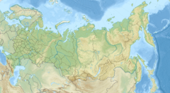
The Popigay (Russian: Попигай) is a river in Krasnoyarsk Krai, Russia. It is a right tributary of the Khatanga. The length of the river is 532 kilometers (331 mi). The area of its drainage basin is 50,300 square kilometers (19,400 sq mi). The river has its source in the Anabar Plateau. It freezes up in October and breaks up in June. Its main tributaries are the Rassokha and Fomich.
The river passes by the Popigay crater, about 900 kilometers (560 mi) northeast of Norilsk.
See also
References
- "Река Попигай in the State Water Register of Russia". textual.ru (in Russian).
- Попигай, Great Soviet Encyclopedia
This Krasnoyarsk Krai location article is a stub. You can help Misplaced Pages by expanding it. |
This article related to a river in the Russian Far East is a stub. You can help Misplaced Pages by expanding it. |