This is an old revision of this page, as edited by Addbot (talk | contribs) at 17:25, 22 February 2013 (Bot: Migrating 18 interwiki links, now provided by Wikidata on d:q508594 (Report Errors)). The present address (URL) is a permanent link to this revision, which may differ significantly from the current revision.
Revision as of 17:25, 22 February 2013 by Addbot (talk | contribs) (Bot: Migrating 18 interwiki links, now provided by Wikidata on d:q508594 (Report Errors))(diff) ← Previous revision | Latest revision (diff) | Newer revision → (diff) Autonomous prefecture in Qinghai, China| Haibei Prefecture 海北州 | |
|---|---|
| Autonomous prefecture | |
| 海北藏族自治州 · མཚོ་བཡྣང་བོད་རིགས་རང་སྐྱོང་ཁུལ | |
| Chinese transcription(s) | |
| • Chinese characters | 海北藏族自治州 |
| • Hanyu Pinyin | Hǎiběi Zàngzú Zìzhìzhōu |
| Tibetan transcription(s) | |
| • Tibetan script | མཚོ་བཡྣང་བོད་རིགས་རང་སྐྱོང་ཁུལ |
| • Wylie | mtsho-byang bod-rigs rang-skyong-khul |
| • Tibetan pinyin | Cojang Poirig Ranggyong Kü |
 Qilian Mountains Qilian Mountains | |
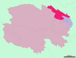
 Location of Haibei Prefecture in Qinghai Location of Haibei Prefecture in Qinghai | |
| Country | China |
| Province | Qinghai |
| Prefecture seat | Haiyan County |
| Time zone | UTC+8 (China Standard) |
Haibei Tibetan Autonomous Prefecture (Chinese: 海北藏族自治州; Tibetan: མཚོ་བཡྣང་བོད་རིགས་རང་སྐྱོང་ཁུལ་) is an autonomous prefecture of northeastern Qinghai province in Western China. The prefecture has an area of 39,354 square kilometres (15,195 sq mi) and its seat is Haiyan County. Its name literally means "north of Qinghai Lake."
Demographics
According to the 2000 census, Haibei has 258,922 inhabitants with a population density of 6.58 inhabitants/km².
The following is a list of ethnic groups in the prefecture, 2000 census.
| Ethnicity | Population | Percentage |
|---|---|---|
| Han | 94,841 | 36.63% |
| Hui | 79,190 | 30.58% |
| Tibetan | 62,520 | 24.15% |
| Mongol | 13,087 | 5.05% |
| Tu | 7,806 | 3.01% |
| Salar | 901 | 0.35% |
| Others | 577 | 0.23% |
Subdivisions
The prefecture is subdivided into 4 county-level divisions: 3 counties and 1autonomous county:
| Map | ||||||||
|---|---|---|---|---|---|---|---|---|

| ||||||||
| # | Name | Hanzi | Hanyu Pinyin | Tibetan | Wylie | Population (2003 est.) |
Area (km²) | Density (/km²) |
| 1 | Haiyan County | 海晏县 | Hǎiyàn Xiàn | ཧའེ་ཡན་རྫོང་ | ha'e yan rdzong | 30,000 | 4,348 | 7 |
| 2 | Qilian County | 祁连县 | Qílián Xiàn | ཆི་ལེན་རྫོང་ | chi len rdzong | 50,000 | 15,610 | 3 |
| 3 | Gangca County | 刚察县 | Gāngchá Xiàn | རྐང་ཚ་རྫོང་ | rkang tsha rdzong | 40,000 | 12,500 | 3 |
| 4 | Menyuan Hui Autonomous County | 门源回族自治县 | Ményuán Huízú Zìzhìxiàn |
མོང་ཡོན་ཧུའེ་རིགས་རང་སྐྱོང་རྫོང་ | mong yon hu'e rigs rang skyong rdzong |
150,000 | 6,896 | 22 |
| County-level divisions of Qinghai Province | |||||||||||||
|---|---|---|---|---|---|---|---|---|---|---|---|---|---|
| Prefecture-level cities |
| ||||||||||||
| Autonomous prefectures |
| ||||||||||||
| |||||||||||||
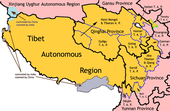
| Tibetan-designated autonomous areas in China | |||||||||
|---|---|---|---|---|---|---|---|---|---|
| Regions |
|  | |||||||
| Prefectures and counties |
| ||||||||
36°57′N 100°54′E / 36.95°N 100.90°E / 36.95; 100.90
This Tibet location article is a stub. You can help Misplaced Pages by expanding it. |