This is an old revision of this page, as edited by EncMstr (talk | contribs) at 17:06, 23 December 2006 (revert vandal 67.170.33.237 (talk) to last version by KyraVixen: misrepresented edit summary is vandalism). The present address (URL) is a permanent link to this revision, which may differ significantly from the current revision.
Revision as of 17:06, 23 December 2006 by EncMstr (talk | contribs) (revert vandal 67.170.33.237 (talk) to last version by KyraVixen: misrepresented edit summary is vandalism)(diff) ← Previous revision | Latest revision (diff) | Newer revision → (diff)
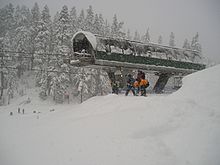
Alpental 1.) lit. "alpine valley," (Ger.) alt. "Alpenthal" 2.) A particular valley located in King County, Washington, US, about a mile north of I-90 at Snoqualmie Pass, in the Washington Cascades, about 50 miles east of Seattle. It offers skiing, snowboarding, snowshoeing, hiking, climbing and other alpine activities. Geologically, it is a three sided canyon where the valley is flanked by Denny Mountain on the SW, Chair Peak to the NW, and Mt. Snoqualmie to the NE, with Source Lake occupying the upper valley area and feeding the South Fork of the Snoqualmie River, which eventually makes its way to Snoqualmie Falls. 3.) One of the four ski area base areas comprising The Summit at Snoqualmie is located in the same area operating lifts on the NE (lower mountain), and SE (upper mountain) side of Denny Mountain.
Recreation
This has traditionally been one of the most popular outdoor recreation areas in the Cascades, with a rich history of Northwest climbing starting from this valley floor. The ski concession is part of The Summit at Snoqualmie ski area, and offers excellent advanced backcountry skiing access to pristine wilderness and roadless areas.
The upper parking lots, traditionally known as lots 3 and 4 at Alpental are public land, managed by the USFS Mt. Baker/Snoqualmie National Forest, and are free and open to the public under Article I. F. in the . These lots are plowed and open to the public as part of the agreement with the USFS which issues the ski area's Special Use Permit.
The upper lots not only are a convenient place to park and ski down to the lifts for skiing and snowboarding, they have historically been an excellent point to access many winter climbing, skiing, and snowshoeing routes. Lot 4 is described as the start of several tours in Martin Volken's guidebook; Backcountry Skiing Snoqualmie Pass. More information about the climbing routes, geology, and topography of the area can be found in Fred Beckey's Cascade Alpine Guide (3 vols.) (Mountaineers Press, 1973-1981) Columbia River to Stevens Pass ISBN 0-89886-577-8
Recent Development Controversy
Booth Creek Ski Holdings Inc, and sub-contractor SE Group are petitioning the USFS for permission to develop Alpental's backcountry. Organized opposition exists for this proposal.
References
- Martin Volken (2001-12-01). Backcountry Skiing Snoqualmie Pass. Falcon. ISBN 0-7627-1066-7.
- Jim Nelson and Peter Potterfield (1993). Selected Climbs in the Cascades. The Mountaineers. p. 46. ISBN 0-89886-767-3.
- "Draft environmental impact statement (DEIS)" (pdf). USFS. 2002-10-01. Retrieved 2006-09-28.
External links
- The Summit at Snoquamie ski area
- Alpental website History of Alpental and virtual tours
- freealpental.org Conservation (stewardship/public access) group opposing backcountry development