This is an old revision of this page, as edited by 67.170.33.237 (talk) at 00:15, 24 December 2006 (censored info restored). The present address (URL) is a permanent link to this revision, which may differ significantly from the current revision.
Revision as of 00:15, 24 December 2006 by 67.170.33.237 (talk) (censored info restored)(diff) ← Previous revision | Latest revision (diff) | Newer revision → (diff)
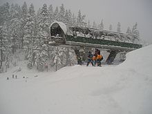
Alpental 1.) lit. "alpine valley," (Ger.) alt. "Alpenthal" 2.) A particular valley located in King County, Washington, US, about a mile north of I-90 at Snoqualmie Pass, in the Washington Cascades, about 50 miles east of Seattle. It offers skiing, snowboarding, snowshoeing, hiking, climbing and other alpine activities. Geologically, it is a three sided canyon where the valley is flanked by Denny Mountain on the SW, Chair Peak to the NW, and Mt. Snoqualmie to the NE, with Source Lake occupying the upper valley area and feeding the South Fork of the Snoqualmie River, which eventually makes its way to Snoqualmie Falls. 3.) One of the four ski area base areas , comprising The Summit at Snoqualmie (owned by Booth Creek Ski Holdings Inc., of which controlling shares are owned by George N. Gillett Jr.) is located in the same area operating lifts on the NE (lower mountain), and SE (upper mountain) side of Denny Mountain and operates under a Special Use Permit issued by the USFS Mt Baker-Snoqualmie National Forest.
Recreation
This has traditionally been one of the most popular outdoor recreation areas in the Cascades, with a rich history of Northwest climbing starting from this valley floor. The ski concession is part of The Summit at Snoqualmie ski area, and offers excellent advanced backcountry skiing access to pristine wilderness and roadless areas. From the upper chair (chair 2, or "Edelweiss," one can ski down the "Internationale," or NE slope of Denny Mountain, and traverse high, far up the valley to "Piss Pass," where one can either descend, or climb up and over the ridge of Denny Mountain, and descend to "Pinapple Pass." This is the far basin where a large alpine bowl offers excellent skiing, and Many peaks including Chair, Bryant, and the Tooth can be accessed for winter climbing.
The upper parking lots, traditionally known as lots 3 and 4 at Alpental are public land, managed by the USFS Mt. Baker/Snoqualmie National Forest, and are free and open to the public under Article I. F. in the . These lots are plowed and open to the public as part of the agreement with the USFS which issues the ski area's Special Use Permit.
The upper lots not only are a convenient place to park and ski down to the lifts for skiing and snowboarding, they have historically been an excellent point to access many winter climbing, skiing, and snowshoeing routes. Lot 4 is described as the start of several tours in Martin Volken's guidebook; Backcountry Skiing Snoqualmie Pass. Here is an excerpt:
Approach: Take Interstate 90 to the Snoqualmie Pass west exit. Drive on Alpental Road to the uppermost parking lot (3,220 feet). Leave your vehicle here.
From the parking lot you'll see a groomed path leading deeper into the Alpental valley. Follow this path to the end. From here you continue up the valley, staying well above and south of the Snoqualmie River. Be aware that the north slopes of the valley are steep and very avalanche prone.
Volken, Martin Backcountry Skiing Snoqualmie Pass A Falcon Guide 2002, The Globe Pequot Press pp.71, 73, 74, 77, 81, 84,87, 89,91, 93, 95, 98
There are indeed many opportunities for climbing as well as touring from Lot 4. For example if one wanted to climb Chair Peak (or the Tooth, or Bryant Peak) in the winter as Jim Nelson and Peter Potterfield describe in their guide:
The difficulty of this approach varies, depending on snow conditions. Drive I-90 to Snoqualmie Pass and Exit 52; cross under the freeway by heading north, and follow signs to Alpental. Drive Alpental Road north 2 miles to the upper parking lot.. Hike upvalley, staying left (south) of the creek, to the head of the valley above Source Lake. This area is prone to avalanche. Use extreme caution. Nelson, Jim and Potterfield, Peter, Selected Climbs in the Cascades, The Mountaineers,/Seattle 1993, p 46.
For more information about the climbing routes, geology, and topography refer to Fred Beckey's Cascade Alpine Guide (3 vols.) (Mountaineers Press, 1973-1981) Columbia River to Stevens Pass ISBN 0-89886-577-8
Recent Development Controversy
Booth Creek Ski Holdings Inc, and sub-contractor SE Group are petitioning the USFS for permission to develop Alpental's backcountry. Organized opposition exists for this proposal.
References
- Martin Volken (2001-12-01). Backcountry Skiing Snoqualmie Pass. Falcon. ISBN 0762710667.
- Jim Nelson and Peter Potterfield (1993). Selected Climbs in the Cascades. The Mountaineers. p. 46. ISBN 0898867673.
- "Draft environmental impact statement (DEIS)" (pdf). USFS. 2002-10-01. Retrieved 2006-09-28.
External links
- The Summit at Snoquamie ski area
- Alpental website History of Alpental and virtual tours
- freealpental.org Conservation (stewardship/public access) group opposing backcountry development