You can help expand this article with text translated from the corresponding article in German. (May 2018) Click for important translation instructions.
|
| Arnoldsweiler | |
|---|---|
| Ortsteil of Düren | |
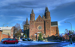
 Church of Saint Arnold Church of Saint Arnold | |
 Coat of arms Coat of arms | |
| Location of Arnoldsweiler | |
  | |
| Coordinates: 50°50′17″N 6°29′27″E / 50.83806°N 6.49083°E / 50.83806; 6.49083 | |
| Country | Germany |
| State | North Rhine-Westphalia |
| District | Düren |
| Town | Düren |
| Area | |
| • Total | 9.51 km (3.67 sq mi) |
| Elevation | 118 m (387 ft) |
| Population | |
| • Total | 3,185 |
| • Density | 330/km (870/sq mi) |
| Time zone | UTC+01:00 (CET) |
| • Summer (DST) | UTC+02:00 (CEST) |
| Postal codes | 52353 |
| Dialling codes | 02421 |
Arnoldsweiler is a village in Nordrhein-Westfalen, Germany. It is part of the town Düren, situated between Cologne and Aachen. Its population was 3,185 in 2017.
History
The village is named after the late 8th century AD Saint Arnold of Arnoldsweiler, a charitable Greek musician at the court of Charlemagne.
References
- "Stadt Düren, Bevölkerung". Archived from the original on 2018-03-16. Retrieved 2018-05-07.
This North Rhine-Westphalia location article is a stub. You can help Misplaced Pages by expanding it. |