Municipality in Baku, Azerbaijan
| Balaxanı Balaxana | |
|---|---|
| Municipality | |
        | |
 | |
| Coordinates: 40°27′42″N 49°55′12″E / 40.46167°N 49.92000°E / 40.46167; 49.92000 | |
| Country | |
| City | Baku |
| Raion | Sabunchu |
| Population | |
| • Total | 11,615 |
| Time zone | UTC+4 (AZT) |
| • Summer (DST) | UTC+5 (AZT) |
Balaxanı or Balakhani (Tat: Balxuni) is a settlement and municipality near Baku, Azerbaijan, on the Absheron Peninsula. Taking advantage of the area's oil pools, a 35 m deep well was dug manually in 1593. The Russians built the first oil-distilling factory here in 1837. In the 1886 official census, 2,843 ethnic Tats were living here.
As of 2015 its population was 11,615.


Places of interest
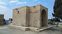
- Shah Sefi's Caravanserai, monument
-
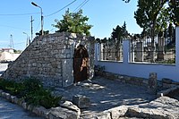
 Balakhani ovdan
-
 Shahla mosque
-
 Balakhani houses
-
 Balakhani street
-

Notable natives
- Sadig Rahimov, Chairman of the Council of Ministers of Azerbaijan SSR (1954–1958)
- Kampan Gadimov [az], oil magnate and philanthropist
See also
References
- World Gazetteer: Azerbaijan – World-Gazetteer.com
- Smil, Vaclav (2017). Energy and Civilization: A History. Cambridge: The MIT Press. p. 246. ISBN 9780262035774.
- Свод статистических данных о населении Закавказского края, извлеченных из посемейных списков 1886 г.
- "Рагимов Садых Гаджияр Али оглы". Справочник по истории Коммунистической партии и Советского Союза 1898 - 1991.
External links
This Baku location article is a stub. You can help Misplaced Pages by expanding it. |
