| Kadamtali Thana কদমতলী থানা | |
|---|---|
| Thana | |
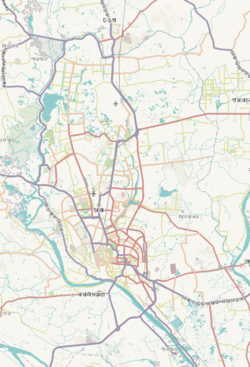
| Expandable map of vicinity of Kadamtali Thana | |
   | |
| Coordinates: 23°41′53″N 90°27′40″E / 23.69806°N 90.46115°E / 23.69806; 90.46115 | |
| Country | |
| Division | Dhaka Division |
| District | Dhaka District |
| Area | |
| • Total | 10.2 km (3.9 sq mi) |
| Elevation | 23 m (75 ft) |
| Population | |
| • Total | 424,190 |
| • Density | 36,505/km (94,550/sq mi) |
| Time zone | UTC+6 (BST) |
| Postal code | 1362 |
| Area code | 02 |
Kadamtali is a Thana of Dhaka District in the Division of Dhaka, Bangladesh. Its area is 10.16 km.
Demographics
| Religions in Kadamtali Thana (2011) | ||||
|---|---|---|---|---|
| Religion | Percent | |||
| Islam | 97.74% | |||
| Hinduism | 2.20% | |||
| Other or not stated | 0.06% | |||
According to the 2011 Census of Bangladesh, Kadamtali Thana had 84,551 households with an average household size of 4.20 and a population of 370,895. Males constituted 54.11% (200,673) of the population while females 45.89% (170,222). Kadamtali had a literacy rate (age 7 and over) of 70.3%, compared to the national average of 51.8%, and a sex ratio of 118.There were 174 floating people in this jurisdiction.
The religious breakdown was Muslim 97.74% (362,499), Hindu 2.20% (8,174), Christian 0.05% (180), Buddhist 0.01% (27), and others 0.01% (15). The ethnic minority people living there were 65 persons in total.
Education
See also: Education in BangladeshThere are four colleges in the upazila. They include A. K. High School and College, Mohammadbug Adorsho College, and Shyampur Model School and College, founded in 2006.
See also
References
- "Geographic coordinates of Dhaka, Bangladesh". DATEANDTIME.INFO. Retrieved 7 July 2016.
- National Report (PDF). Population and Housing Census 2022. Vol. 1. Dhaka: Bangladesh Bureau of Statistics. November 2023. p. 386. ISBN 978-9844752016.
- "Bangladesh Postal Code". Dhaka: Bangladesh Postal Department under the Department of Posts and Telecommunications of the Ministry of Posts, Telecommunications and Information Technology of the People's Republic of Bangladesh. 19 October 2024.
- "Bangladesh Area Code". China: Chahaoba.com. 18 October 2024.
- Molla, Md Tuhin (2012). "Dhaka District". In Islam, Sirajul; Jamal, Ahmed A. (eds.). Banglapedia: National Encyclopedia of Bangladesh (Second ed.). Asiatic Society of Bangladesh.
- "Bangladesh Population and Housing Census 2011 Zila Report – Dhaka" (PDF). bbs.gov.bd. Bangladesh Bureau of Statistics.
- "Community Tables: Dhaka district" (PDF). bbs.gov.bd. 2011.
- Ahmed, Lilima (2012). "Kadamtali Thana". In Islam, Sirajul; Jamal, Ahmed A. (eds.). Banglapedia: National Encyclopedia of Bangladesh (Second ed.). Asiatic Society of Bangladesh.
- "List of Colleges". Department of Secondary and Higher Education. Retrieved 7 October 2021.
This Dhaka Division location article is a stub. You can help Misplaced Pages by expanding it. |