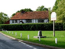
Human settlement in England
| Abberton | |
|---|---|
 | |
| Population | 424 (2011) |
| OS grid reference | TM007190 |
| Civil parish |
|
| District | |
| Shire county | |
| Region | |
| Country | England |
| Sovereign state | United Kingdom |
| Post town | COLCHESTER |
| Postcode district | CO5 |
| Dialling code | 01206 |
| Police | Essex |
| Fire | Essex |
| Ambulance | East of England |
| UK Parliament | |
| 51°50′01″N 0°54′42″E / 51.8337°N 0.9118°E / 51.8337; 0.9118 | |

Abberton is a village in the City of Colchester district of Essex, England. It is located approximately 0.62 mi (1.00 km) east of Abberton Reservoir and is 4.2 mi (6.8 km) south of Colchester. The village is in the parliamentary constituency of North Essex. The town is served by Abberton and Langenhoe Parish Council.
Etymology
The word Abberton is derived from 'Eadburg's estate' (Ēadburge + tūn).
History
Abberton is recorded in the Domesday Book of 1086-87 as Edburghetuna and as Edburgetuna in the Hundred of Winstree, when it was part of the lands of Count Eustace in Essex, held by Ralph de Marcy and further held by Ranulf Peverel in demesne; it was held by Siward, a free man, as a manor in the time of King Edward the Confessor before the Norman Conquest of 1066. It was later recorded as Eadburgetona in 1108, Adbur(u)g(h)(e)ton(e) in 1208–1321, Adburthon in 1280, also Abberton from 1230.
Abberton was among the villages which suffered damage from the 1884 Colchester earthquake: chimneys had fallen to the ground, brick walls had cracked and many side walls of houses had collapsed; the rectory which was being built at the time also suffered considerable damage.
Church

The Church at Abberton is St Andrew. It is a Grade II* listed building and originates from at least the 14th century. It is located at the end of Rectory Lane, approximately three hundred yards from Abberton Reservoir.
References
- UK Census (2011). "Local Area Report – Abberton Parish (E04003978)". Nomis. Office for National Statistics. Retrieved 2 March 2019.
- "Parish/Town councils and councillors". www.colchester.gov.uk. Archived from the original on 26 September 2006. Retrieved 21 January 2007.
- ^ Watts, Victor (2007). The Cambridge Dictionary of English Place-Names. Cambridge University Press. p. 1. ISBN 978-0521168557.
- Williams, Ann; G H Martin (2003). Domesday Book: A Complete Translation. London: Penguin. pp. 990, 1025, 1303. ISBN 978-0-14-143994-5.
- "Severe Earthquake in Essex and Suffolk - Abberton". Chelmsford Chronicle. No. 6231. 25 April 1884. p. 7. Retrieved 2 March 2019 – via British Newspaper Archive.
- Historic England. "CHURCH OF ST ANDREW, Abberton (1110914)". National Heritage List for England. Retrieved 2 March 2019.
External links
- Abberton in the Domesday Book
| Human settlements of the City of Colchester in Essex, England | ||
|---|---|---|
| ||
This Essex location article is a stub. You can help Misplaced Pages by expanding it. |