| Adara Kanda | |
|---|---|
| Hagala Mountain | |
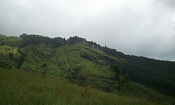
 View from the middle of mountain View from the middle of mountain | |
| Highest point | |
| Elevation | 1,500 m (4,900 ft) |
| Coordinates | 06°45′03″N 80°46′26″E / 6.75083°N 80.77389°E / 6.75083; 80.77389 |
| Geography | |
 | |
| Parent range | Samanala |
| Climbing | |
| Easiest route | via Belihuloya |
Adara Kanda, (Sinhala: ආදරවන්තයන්ගේ කන්ද) also known as Paraviyangala, and commonly known as Lovers' Peak, is a mountain in Sri Lanka. It falls within the Kalupahana mountain range. It is located approximately 5 km (3.1 mi) north east of Belihuloya in the Sabaragamuwa Province of Sri Lanka.
The mountain's peak is at an elevation of 1,500 m (4,900 ft).
Nearby are the Horton Plains and the Samanalawewa reservoir.
See also
References
- "Over 60 acres destroyed by Imbulpe wild fire". Newsfirst. Sri Lanka. 30 July 2018. Archived from the original on 30 July 2018.
- Hasnat, G. N. Tanjina; Hossain, Mohammed Kamal, eds. (2020). Examining International Land Use Policies, Changes, and Conflicts. Advances in Public Policy and Administration. IGI Global. p. 67. ISBN 9781799843733.
This Sabaragamuwa Province, Sri Lanka location article is a stub. You can help Misplaced Pages by expanding it. |