| Adelung | |
|---|---|
| гора Аделунга, Adelunga Toghi | |
 | |
| Highest point | |
| Elevation | 4,301 m (14,111 ft) |
| Listing | Mountains of Uzbekistan |
| Coordinates | 42°07′N 70°58′E / 42.117°N 70.967°E / 42.117; 70.967 |
| Geography | |
 | |
| Country | Uzbekistan |
| Region | Tashkent |
| Parent range | Pskem Mountains |
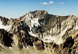
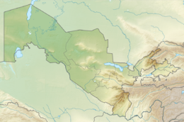
Mount Adelung (Russian: Гора Аделунга) is the highest peak in Pskem Mountains (Russian: Пскемский хребет) in the extreme north-east of the Tashkent Region, Uzbekistan. Mount Adelung is the highest point of Tashkent Province at 4,301 m (14,111 ft), just 2 metres higher than the nearby Mount Beshtor, located a little further to the south-west in the same range, and it is often erroneously identified in various web sources as the "highest point in Uzbekistan". In fact, this honor goes to the Khazret Sultan, a peak with an altitude of 4,643 m in Surxondaryo Region, in the Uzbek part of the Gissar Range, on the border with Tajikistan, which was formerly known as Peak of the 22nd Congress of the Communist Party.
References
- "Topographic map of Adelunga Toghi". opentopomap.org. Retrieved 2023-04-25.
- Physical map of Tashkent Region, Uzgeodezkadastr, Tashkent, 2002 (low resolution)
- Atlas of the Soviet Central Asian Republics, Geodesy and Cartography Authority, Moscow, 1988, in Russian.
- Administrative map of the Republic of Uzbekistan, State Committee of Land Resources, Geodesy, Cartography, and State Cadastre, Tashkent, 2007.
This Uzbekistan location article is a stub. You can help Misplaced Pages by expanding it. |