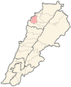
| Ain Akrine عين أكرين | |
|---|---|
| City | |
| Country | |
| Governorate | North Governorate |
| District | Koura District |
| Area | |
| • Total | 1.162 km (0.449 sq mi) |
| Population | |
| • Total | 96 |
| • Density | 83/km (210/sq mi) |
| Time zone | UTC+2 (EET) |
| • Summer (DST) | UTC+3 (EEST) |
| Dialing code | +961 |
Ain Akrine, Ain Aakrine, (Arabic: عين عكرين) is a Maronite village in Koura District of Lebanon. It was established in the early 19th century.
History
Before the 19th century, the land on which Ain Akrine stands today, was owned by AL HAJJ Youssef from Bnehrane. Following a dispute between two brothers, the family of EL KHOURY Ibrahim migrated from Kfarshakhna and settled in Ain Akrine. During the Ottoman occupation, a group of Christians lived in this town to escape oppression. The village is also known as Nawous Town.In 1953, Ain Akrine had a population of 242 living in 36 households.
References
- "Municipal and ikhtiyariah elections in Northern Lebanon" (PDF). The Monthly. March 2010. p. 23. Archived from the original on 3 June 2016. Retrieved 29 October 2016.
{{cite web}}: CS1 maint: bot: original URL status unknown (link) - Ain Akrine Website - History
- Sawaya, Salah Michel (March 1953). Household Income and Expenditure in Al-Kura, Lebanon (PDF). Scholarworks (M.A.). Beirut, Lebanon: Economics Dept., American University of Beirut, Lebanon. hdl:10938/3411. Archived from the original (PDF) on 24 March 2023. Retrieved 2023-03-24.
External links
- Ain Aakrine, Localiban
34°17′08″N 35°50′48″E / 34.2856°N 35.8467°E / 34.2856; 35.8467
This Lebanon location article is a stub. You can help Misplaced Pages by expanding it. |
