| This article does not cite any sources. Please help improve this article by adding citations to reliable sources. Unsourced material may be challenged and removed. Find sources: "Nariyah" – news · newspapers · books · scholar · JSTOR (January 2013) (Learn how and when to remove this message) |
| Nariyah | |
|---|---|
 | |
| Coordinates: 27°28′11.48″N 48°29′3.74″E / 27.4698556°N 48.4843722°E / 27.4698556; 48.4843722 | |
| Country | Saudi Arabia |
| Province | Eastern Province |
| Time zone | UTC+3 (EAT) |
| • Summer (DST) | UTC+3 (EAT) |
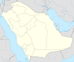
Nariyah, No'ayriyah, Nariya or An Nariyah is a town situated at Eastern Province, Saudi Arabia. It has approximate total area of approximately 25 square km. It is located 150 km away from Jubail . It has a population over 60,000 (2017 Census). At the start of the Gulf war in 1990 hundreds of Kuwaiti refugees flooded into the town as it borders Kuwait.
Transportation
Airport
The city is served by King Fahd International Airport, the terminal is at a driving distance of 190 km to the south east.
See also
| 1,000,000 and more | |
|---|---|
| 300,000-999,999 | |
| <300,000 | |
| Source: cdsi.gov.sa | |
| Saudi Arabia articles | |||||||||
|---|---|---|---|---|---|---|---|---|---|
| History |  | ||||||||
| Geography | |||||||||
| Politics |
| ||||||||
| Economy | |||||||||
| Society |
| ||||||||
This article about the geography of Saudi Arabia is a stub. You can help Misplaced Pages by expanding it. |