| Andle Stone | |
|---|---|
 Andle Stone - a huge natural boulder Andle Stone - a huge natural boulder | |
| Location | Derbyshire |
| Coordinates | 53°09′49″N 1°38′31″W / 53.163550°N 1.642045°W / 53.163550; -1.642045 |
| OS grid reference | SK241630 |
| Architectural style(s) | British pre-Roman Architecture |
 | |
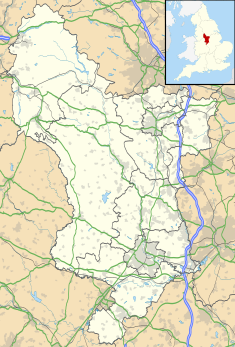
The Andle Stone is a large gritstone boulder on Stanton Moor in Derbyshire. The stone block is 6m long, 4m high and lies within a low, circular, dry stone wall enclosure. It is covered in cup and ring marks. It is also known as the Oundle Stone, the Anvil Stone or the Twopenny Loaf.
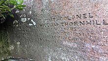
There is a memorial inscription on the west-facing concave face of the boulder, commemorating the Duke of Wellington, Lieutenant Colonel William Thornhill (2nd son of Bache Thornhill of Stanton Hall) and the battles of Assaye and Waterloo. The inscription reads:
| FIELD-MARSHALL DUKE OF WELLINGTON DIED 14 SEPT 1852 AGED 82 YEARS | LIEUT-COLONEL WILLIAM THORNHILL 7 HUSSARS DIED 9 DEC 1851 AGED 71 YEARS | |
| ASSYE 1803 WATERLOO 1815 | ||

The Andle Stone and the nearby Doll Tor stone circle are both on private farmland with no public access rights.
Notes
- Julian Cope (1998). The Modern Antiquarian: A Pre-millennial Odyssey Through Megalithic Britain : Including a Gazetteer to Over 300 Prehistoric Sites. Thorsons Pub. p. 249. ISBN 978-0-7225-3599-8. Retrieved 11 April 2013.
- "MDR3734 - Andle Stone (natural rock), Stanton Moor, Stanton in the Peak". Derbyshire Historic Environment Record. Retrieved 16 March 2023.
- "The Waterloo Roll Call with Biographical Notes and Anecdotes, by Charles Dalton". www.gutenberg.org. Retrieved 16 March 2023.
- "Field Marshal the Duke Of Wellington And Lieutenant Colonel W Thornhill". Imperial War Museums. Retrieved 16 March 2023.
- OL24 White Peak area (Map). 1:25000. Explorer. Ordnance Survey. East sheet.
| Ceremonial county of Derbyshire | |
|---|---|
| Derbyshire Portal | |
| Unitary authorities | Derby |
| Boroughs or districts | |
| Major settlements (cities in italics) |
|
| Rivers | |
| Topics | |
This Derbyshire location article is a stub. You can help Misplaced Pages by expanding it. |