| This article does not cite any sources. Please help improve this article by adding citations to reliable sources. Unsourced material may be challenged and removed. Find sources: "Arbach" Swabian Rezat – news · newspapers · books · scholar · JSTOR (February 2018) (Learn how and when to remove this message) |
| Arbach | |
|---|---|
 | |
| Location | |
| Country | Germany |
| State | Bavaria |
| Physical characteristics | |
| Mouth | |
| • location | Swabian Rezat |
| • coordinates | 49°06′18″N 10°59′15″E / 49.1049°N 10.9876°E / 49.1049; 10.9876 |
| Basin features | |
| Progression | Swabian Rezat→ Rednitz→ Regnitz→ Main→ Rhine→ North Sea |
| Tributaries | |
| • right | Arbachgraben |
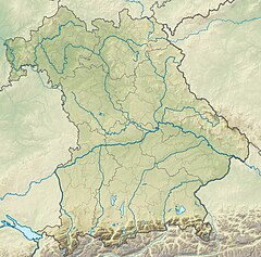
Arbach is a river in Bavaria, Germany. It is a right tributary of the Swabian Rezat near Pleinfeld in the Middle Franconian district Weißenburg-Gunzenhausen.
The Arbach rises at an altitude of 462 m (1,516 ft) above sea level at Walting in Pleinfeld and feeds there the pond Bachweiher. To the north-east of the wood field sector Totenleite, it is fed on its right side by the Arbachgraben, which is coming from the north from Kreisstraße WUG 16 . It flows further north along the Celtic Viereckschanze and then south of the hill Weingartner Berg (467 m (1,532 ft) above sea level) and finally flows at a height of 373 m (1,224 ft) above sea level in Pleinfeld, north of the street Zollgasse, from the right into the Swabian Rezat.
See also
This article related to a river in Bavaria is a stub. You can help Misplaced Pages by expanding it. |