| This article needs additional citations for verification. Please help improve this article by adding citations to reliable sources. Unsourced material may be challenged and removed. Find sources: "Ardgartan" – news · newspapers · books · scholar · JSTOR (March 2016) (Learn how and when to remove this message) |
| Ardgartan | |
|---|---|
 Loch Long at dawn from Ardgarten campsite - geograph.org.uk - 1658026 Loch Long at dawn from Ardgarten campsite - geograph.org.uk - 1658026 | |
 | |
| OS grid reference | NN 27333 02894 |
| Council area |
|
| Lieutenancy area |
|
| Country | Scotland |
| Sovereign state | United Kingdom |
| Post town | Alexandria |
| Postcode district | G83 |
| Dialling code | 01301 |
| UK Parliament |
|
| Scottish Parliament |
|
| 56°11′14″N 4°47′02″W / 56.187269°N 4.7839108°W / 56.187269; -4.7839108 | |
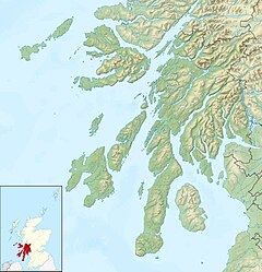
Ardgartan is a hamlet, on the Cowal Peninsula, in Argyll and Bute, Scottish Highlands. It is located on the shores of Loch Long, at the bottom of Glen Croe.
Ardgartan lies within the Argyll Forest Park, which is itself within the Loch Lomond and The Trossachs National Park.
Ardgartan House
The house was used as a youth hostel run by the Scottish Youth Hostels Association and operated for 70 years until it was closed in 2002.
References
External links
- Map sources for Ardgartan
This Argyll and Bute location article is a stub. You can help Misplaced Pages by expanding it. |