Human settlement in Scotland
Ardoch
| |
|---|---|
 | |
| Country | Scotland |
| Sovereign state | United Kingdom |
| Police | Scotland |
| Fire | Scottish |
| Ambulance | Scottish |
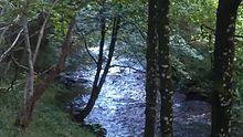
The Ardoch Burn is a stream in Stirling council area, Scotland, which flows from the Braes Of Doune into the River Teith at Inverardoch, just behind Doune Castle.
Etymology
From the Scottish Gaelic ard, which translates into English as "high," with the -ach suffix, which could mean "place" or "field." In Perthshire and Stirlingshire Gaelic the ends of words were dropped. Achadh, the Gaelic for field, often becomes ach.
Course

The Ardoch Burn begins at Loch Mahaick in the high braes (56°14′10″N 4°05′03″W / 56.2361°N 4.0842°W / 56.2361; -4.0842 (Ardoch Burn (source))), eventually reaching the end of its journey where it meets the River Teith at Inverardoch (56°10′53″N 4°02′50″W / 56.1815°N 4.0471°W / 56.1815; -4.0471 (Ardoch Burn (mouth))). It has several tributaries along its course as it drains the south western slopes of Uamh Mhor before passing Kilbride Castle and west to Doune where it meets the River Teith. The stream's course flows broadly southwards and is approximately 7 miles in length from source to its convergence with the River Teith.
References
- ^ "Overview of Ardoch Burn". Scottish-places.info. Retrieved 29 March 2013.
- ^ MacKay, Moray S.(1953). Doune Historical Notes, p. 7 - 8. Forth Naturalist and Historian Board ISBN 0950696250.
External links
Map all coordinates using OpenStreetMapDownload coordinates as:
Categories: