21°26′07″N 79°07′25″E / 21.4351735°N 79.1235352°E / 21.4351735; 79.1235352
Taluka in Maharashtra, India| Arjuni Morgaon taluka | |
|---|---|
| Taluka | |
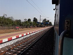
 Arjuni Station Arjuni Station | |
| Arjuni-Morgaon TalukaLocation in Gondia district (MH), India | |
| Country | |
| State | Maharashtra |
| Regions | Vidharbha |
| District | Gondia District |
| Headquarters | Arjuni Morgaon Town |
| Area | |
| • Total | 644.91 km (249.00 sq mi) |
| Population | |
| • Total | 143,512 |
| • Density | 220/km (580/sq mi) |
| • Sex ratio | 935 |
| Time zone | UTC+5:30 (IST) |
| PIN | Arjuni Morgaon - 441701 |
| STD Code | 91-7196 |
| Revenue circle | 5 |
| Average rainfall | 1175 mm |
Arjuni-Morgaon is a taluka in Arjuni Morgaon Subdivision in Maharashtra, India.
Geographic Boundaries
| Places adjacent to Arjuni-Morgaon taluka | |
|---|---|
References
- "Pin Code List, Pincode Search Engine, Postal Codes of India". www.mapsofindia.com. Retrieved 1 May 2019.
- Pratibha Pande; Neema Pathak (2019). National Parks and Sanctuaries in Maharashtra: A state profile. Bombay Natural History Society. ISBN 978-81-902647-1-6.
- T. k. Roy; M. Guruswamy; P. Arokiasamy (1 January 2019). Population, Health, and Development in India: Changing Perspectives. Rawat Publications. ISBN 978-81-7033-882-6.
This Gondia district, Maharashtra, India location article is a stub. You can help Misplaced Pages by expanding it. |