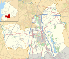
Human settlement in England
| Astley Village | |
|---|---|
 Astley Village Community Centre (2014) Astley Village Community Centre (2014) | |
  | |
| Population | 3,005 (2011 Census) |
| OS grid reference | SD575185 |
| Civil parish |
|
| District | |
| Shire county | |
| Region | |
| Country | England |
| Sovereign state | United Kingdom |
| Post town | CHORLEY |
| Postcode district | PR6, PR7 |
| Dialling code | 01257 |
| Police | Lancashire |
| Fire | Lancashire |
| Ambulance | North West |
| UK Parliament | |
| |
Astley Village is a civil parish in the Borough of Chorley in Lancashire, England, covering a suburb of Chorley. According to the 2011 census, its population was 3,005.
History
Astley was constructed in the 1970s as a new village. The civil parish was created on 1 April 1991, prior to which the village was divided between the unparished area of Chorley and the parish of Euxton.
Community
Astley Village is best known for Astley Park, which hosted the Royal Lancashire Show for a number of years.
Long Croft Meadow backs onto Chorley Hospital, and the main road through the village is Chancery Road. The village is bypassed via West Way (B5252), a link road opened in 1984 to take traffic off the busy Chancery Road.
References
- UK Census (2011). "Local Area Report – Astley Village Parish (E04005142)". Nomis. Office for National Statistics. Retrieved 26 March 2021.
- "The Chorley (Parishes) Order 1991" (PDF). LGBCE. 19 February 1991. Retrieved 18 December 2022.
- "All go for Royal Lancs show". lancashiretelegraph.co.uk. 5 July 2002. Retrieved 9 November 2020.
- "Great final show". theboltonnews.co.uk. 9 August 2002. Retrieved 9 November 2020.
External links
- Astley Village chorley.gov.uk
| Geography of the Borough of Chorley | |||||||||
|---|---|---|---|---|---|---|---|---|---|
| Towns | |||||||||
| Villages |
| ||||||||
| Parishes | |||||||||
| Topography |
| ||||||||