| At-Tanʽīm ٱلتَّنْعِيْم | |
|---|---|
| Neighbourhood | |
 Masjid A'ishah in At-Tan'im Masjid A'ishah in At-Tan'im | |
  | |
| Coordinates: 21°28′57″N 39°48′18″E / 21.48250°N 39.80500°E / 21.48250; 39.80500 | |
| Country | |
| Province | Makkah Region |
| City | Makkah |
| Time zone | UTC+3 (EAT) |
| • Summer (DST) | UTC+3 (EAT) |
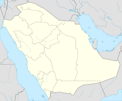
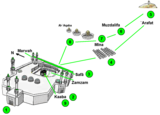
At-Tanʿīm (Arabic: ٱلتَّنْعِيْم) is a neighbourhood of Makkah in western Saudi Arabia. In this district is Masjid A'ishah, a boundary of the Ḥaram, where pilgrims of Ḥajj and ʿUmrah can put on Iḥram.
See also
References
- National Geospatial-Intelligence Agency. GeoNames database entry. (search) Accessed 13 May 2011.
- "Umrah From Masjid e Aisha | Taneem Mosque | Masjid e Ayesha History". Zamzam Blogs. 2021-05-30. Retrieved 2022-09-22.
- Huzaifa, Abu (2014-04-17). "Masjid Aisha". IslamicLandmarks.com. Retrieved 2022-09-22.
- "Masjid Aisha | Hajj & Umrah Planner". Hajjumrahplanner.com. 3 April 2017. Retrieved 2022-10-02.
External links
| Hajj | ||
|---|---|---|
| Every year, from the eighth to the twelfth day of Dhu al-Hijjah. | ||
| Preparation |  | |
| Sequence | ||
| Mosques | ||
| Related | ||
| History | ||
This article about the geography of Saudi Arabia is a stub. You can help Misplaced Pages by expanding it. |