| Austreberthe | |
|---|---|
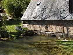
 A view of the Austreberthe A view of the Austreberthe | |
  | |
| Location | |
| Country | France |
| Physical characteristics | |
| Source | |
| • location | Normandy |
| Mouth | |
| • location | Seine |
| • coordinates | 49°28′42″N 0°52′17″E / 49.47833°N 0.87139°E / 49.47833; 0.87139 |
| Length | 18 km (11 mi) |
| Basin features | |
| Progression | Seine→ English Channel |
The Austreberthe (French pronunciation: [ɔstʁəbɛʁt]) is an 18-km river in the Seine-Maritime. Its source is the village of Sainte-Austreberthe. It meets the Seine at Duclair.
The Austreberthe is crossed by the Barentin Viaduct, a noteworthy 30 metre high brick railway bridge built in 1846, about 19-km from Rouen.
References
External links
- (in French) Au fil de l'Austreberthe...
This Normandy geography article is a stub. You can help Misplaced Pages by expanding it. |
This article related to a river in France is a stub. You can help Misplaced Pages by expanding it. |