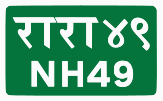
 National Highway 49
 | ||||
|---|---|---|---|---|
| राष्ट्रिय राजमार्ग ४९ | ||||
| Wamitaksar–Rudrabeni | ||||
| NH49 in red | ||||
| Route information | ||||
| Maintained by MoPIT (Department of Roads) | ||||
| Length | 48.40 km (30.07 mi) | |||
| Major junctions | ||||
| North end | Wamitaksar | |||
| Sourh end | Rudrabeni | |||
| Location | ||||
| Country | Nepal | |||
| Provinces | Lumbini Province | |||
| Districts | Gulmi District | |||
| Highway system | ||||
| ||||
National Highway NH49 (Wamitaksar–Rudrabeni, Shantipur road, Badigad Corridor) is a national highway in Nepal. The highway is located in Gulmi District in Lumbini Province. The total length of the highway is 48.40 kilometres (30.07 mi).
It was a Feeder Road F132 which upgraded to NH49. Wamitaksar-Rudrabeni road section runs along the left bank of Badigad River.
References
- "Statics of National Highway 2020_21" (PDF). Nepal in data. Department of Roads (Nepal). 2021-09-22. Retrieved 2024-06-18.
- "Statics of Strategic Road Network". Department of Roads (Nepal). 2023. Retrieved 2024-06-18.
- "Existing Highway and Proposed Extension". DOR. Retrieved 18 Jul 2024.
- "Case Study of Wamitaksar Rudrabeni Road Section" (PDF). Department of Geology Trichandra Campus Tribhuvan University. 2014. Retrieved 18 Jul 2024.
External links
- Map of National Highways of Nepal
- SNH-2021/22
- The Ridi-Rudrabeni-Wamitaksar road section which has been disrupted due to heavy rain for a week has not come into operation yet
- Rudrabeni Bazar Blacktop and Badigad Corridor Construction Work in Satyawati Rural Municipality 1 Gulmi
| Highways |
| |||||||||||||||
|---|---|---|---|---|---|---|---|---|---|---|---|---|---|---|---|---|
| Expressway | ||||||||||||||||
| Ringroads | ||||||||||||||||
| Provincial Highway |
| |||||||||||||||
This Nepalese road or road transport-related article is a stub. You can help Misplaced Pages by expanding it. |