| Baima | |
|---|---|
| Town | |
| Chinese transcription(s) | |
| • Traditional | 白瑪 |
| • Simplified | 白玛 |
| • Pinyin | Báimǎ |
 | |
| Coordinates: 30°3′N 96°54′E / 30.050°N 96.900°E / 30.050; 96.900 | |
| Country | People's Republic of China |
| Region | Tibet Autonomous Region |
| Prefecture | Chamdo Prefecture |
| County | Baxoi County |
| Nearby settlements (distance) | Bamda 20.5 mi (33 km) Chongsar 29.4 mi (47 km) |
| Elevation | 3,772 m (12,378 ft) |
| Population | |
| • Total | 378 |
| • Major Nationalities | Tibetan |
| • Regional dialect | Tibetan language |
| Time zone | +8 |
| Climate | Cwb |
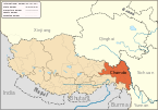
Baima (Tibetan: པད་མ།, Wylie: pad ma, ZYPY: Baima; Chinese: 白玛; pinyin: Báimǎ) is a town in Baxoi County, Chamdo Prefecture of the Tibet Autonomous Region of the People's Republic of China. It lies at an altitude of 3,772 metres (12,378 ft). As of 2020, it administers Baima Residential Community and the following eight villages:
- Yoiba Village (ཡོལ་པ, 约巴村)
- Zhubba Village (སྒྲུབ་པ, 珠巴村)
- Nairab Village (གནས་རབ, 乃然村)
- Rixi Village (རི་གཞི, 日吉村)
- Wanbêb Village (ཝ་འབེབས, 旺比村)
- Samar Village (ས་དམར, 沙木村)
- Dêngka Village (སྟེང་ཁ, 丁卡村)
- Xaiba Village (གཤས་པ, 西巴村)
See also
Notes
- Wu Zhenhua (武振华), Xizang Diming (西藏地名; Place Names in Tibet), p.27, Chinese Zangxue Press (中国藏学出版社) 1996, ISBN 7-80057-284-6
- 2020年统计用区划代码和城乡划分代码:八宿县 (in Chinese). National Bureau of Statistics of the People's Republic of China. Retrieved 7 January 2021.
- 2020年统计用区划代码和城乡划分代码:白玛镇 (in Chinese). National Bureau of Statistics of the People's Republic of China. Retrieved 7 January 2021.
- "Geographical Names of Qamdo Prefecture-Level City". Institute of the Estonian Language. Retrieved 7 January 2021.
| Chamdo | ||||||
|---|---|---|---|---|---|---|
| County-level divisions |
|  | ||||
| Settlements | ||||||
| Sciences | ||||||
| Cultures | ||||||
This Chamdo, Tibet location article is a stub. You can help Misplaced Pages by expanding it. |