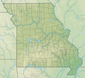
| Bald Knob | |
|---|---|
  | |
| Highest point | |
| Elevation | 480 m (1,570 ft) |
| Prominence | 29 m (95 ft) |
| Isolation | 0.87 km (0.54 mi) |
| Coordinates | 37°42′53″N 90°42′34″W / 37.71477°N 90.709333°W / 37.71477; -90.709333 |
| Geography | |
| Location | Missouri |
| Parent range | St. Francois Mountains |
Bald Knob is a summit in St. Francois County, Missouri, United States. It has an elevation of 1,574 feet (480 m), and was named after its treeless peak.
References
- ^ "Bald Knob".
- Zimmer, Gertude Minnie. Place Names Of Five Southeast Counties Of Missouri. University of Missouri--Columbia, 1944.
| Mountains of Missouri | |||||||
|---|---|---|---|---|---|---|---|
| Ozarks |
| ||||||
| Others |
See also: U.S. Interior Highlands | ||||||
37°39′25″N 90°30′51″W / 37.6569958°N 90.5142889°W / 37.6569958; -90.5142889
This Saint Francois County, Missouri state location article is a stub. You can help Misplaced Pages by expanding it. |