| Balele Mountains | |
|---|---|
| (Balelesberg / Belelasberg) | |
 Balele Mountains rising behind Utrecht Balele Mountains rising behind Utrecht | |
| Highest point | |
| Peak | Vaalkop |
| Elevation | 1,845 m (6,053 ft) |
| Listing | List of mountain ranges of South Africa |
| Coordinates | 27°32′43″S 30°08′21″E / 27.5453°S 30.1392°E / -27.5453; 30.1392 |
| Geography | |
 | |
| Country | South Africa |
| Geology | |
| Rock type | dolerite |
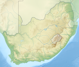
The Balele Mountains (Balelesberg or sometimes Belelasberg in Afrikaans) are a mountain massif largely located in the KwaZulu-Natal province in South Africa.
Geography
The Balele Mountains stretch north of the town of Utrecht, which lies at their foot, south-east of Wakkerstroom and Volksrust (in Mpumalanga), and north-east of the Newcastle region. Vaalkop is the highest point.
Geology
As on the eastern slopes of the Drakensberg, the dolerite dominates the collapsing cliffs of the Balele Mountains.
History
Early in the 20th century, the Utrecht Collieries Company began mining coal in the Balele Mountains. In 1906, the governor of Natal decided to build a railway line between Utrecht and Newcastle. The line was inaugurated in 1910 by the then governor Lord Methuen.
References
- G. W. Begg, The Wetlands of Natal, 1989, p.84
- Amajuba District Municipality Environnemental Management Framework Amajuba District Municipality Environnemental Management Framework - Draft Status Quo Report, p.XIV
- "PART 13 The Natal Main Line – from north of Ladysmith to Charlestown on the Transvaal border - including the branch to Utrecht from Newcastle compiled by Les Pivnic and Bruno Martin. © - Soul of A Railway". sites.google.com. Archived from the original on 28 August 2021. Retrieved 2 December 2020.