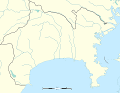
| B15 Bandōbashi Station 阪東橋駅 | |||||||||||
|---|---|---|---|---|---|---|---|---|---|---|---|
 Entrance No.4 Entrance No.4 | |||||||||||
| General information | |||||||||||
| Location | Yayoi-chō 5-48, Naka, Yokohama, Kanagawa (横浜市中区弥生町五丁目48) Japan | ||||||||||
| Operated by | Yokohama City Transportation Bureau | ||||||||||
| Line(s) | |||||||||||
| Platforms | 1 island platform | ||||||||||
| Tracks | 2 | ||||||||||
| Other information | |||||||||||
| Station code | B15 | ||||||||||
| History | |||||||||||
| Opened | 16 December 1972; 52 years ago (1972-12-16) | ||||||||||
| Passengers | |||||||||||
| 2008 | 8,150 daily | ||||||||||
| Services | |||||||||||
| |||||||||||
Bandōbashi Station (阪東橋駅, Bandōbashi-eki) is an underground metro station located in Naka-ku, Yokohama, Kanagawa, Japan operated by the Yokohama Municipal Subway’s Blue Line (Line 1). It is 18.1 kilometers from the terminus of the Blue Line at Shōnandai Station.
Lines
Station layout
Bandōbashi Station is an underground station with a single island platform serving two tracks.
Platforms
| 1 | ■ Blue Line (Yokohama) | Kamiōoka, Totsuka, Shōnandai |
| 2 | ■ Blue Line (Yokohama) | Kannai, Yokohama, Shin-Yokohama, Azamino |
History
Bandōbashi Station was opened on 16 December 1972. Platform screen doors were installed in September of 2007.
References
- Harris, Ken and Clarke, Jackie. Jane's World Railways 2008-2009. Jane's Information Group (2008). ISBN 0-7106-2861-7
External links
- Bandōbashi Station (Blue Line) (in Japanese)
35°26′14.5″N 139°37′30″E / 35.437361°N 139.62500°E / 35.437361; 139.62500
This Kanagawa Prefecture railroad station-related article is a stub. You can help Misplaced Pages by expanding it. |


