| Baran Барань | |
|---|---|
| Town | |
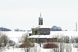
 Church of the Transfiguration Church of the Transfiguration | |
 Flag Flag Coat of arms Coat of arms | |
 | |
| Coordinates: 54°29′N 30°20′E / 54.483°N 30.333°E / 54.483; 30.333 | |
| Country | Belarus |
| Region | Vitebsk Region |
| District | Orsha District |
| Population | |
| • Total | 10,245 |
| Time zone | UTC+3 (MSK) |
| License plate | 2 |
Baran (Belarusian: Барань, romanized: Barań; Russian: Барань; Polish: Barań; Lithuanian: Baranis) is a town in Orsha District, Vitebsk Region, Belarus. It is located in the southeast of the region and a few kilometers from the city of Orsha. In 2009, its population was 11,662. As of 2024, it has a population of 10,245.
History
Baran was first mentioned in 1470 and chartered in 1598 by Krzysztof Radziwiłł. At the time, the area belonged to Poland. In 1772, during the First Partition of Poland, Baran was transferred to Russia and became a selo, the center of Baranskaya Volost of Orshansky Uyezd within Mogilev Governorate. In 1777, the provinces were abolished, and Baran became a selo in Orshansky Uyezd. In 1919, Mogilev Governorate was abolished, and Baran was transferred to Gomel Governorate. In 1920, Orshansky Uyezd, along with Baran, was transferred to Vitebsk Governorate, and in 1924, the governorate was abolished.
From 1924, Baran was part of Orsha District, which belonged to Vitebsk Okrug of the Byelorussian SSR within the Soviet Union. In 1935, Baran received the status of urban-type settlement. On 15 January 1938, Vitebsk Region was established, and Orsha District, along with Baran, was transferred to the region.
During World War II, Baran was occupied by German troops from 16 July 1941 and it remained under military occupation until February 1944. The 1939 Soviet census recorded 81 Jews living there out of a total population of 1,589. Some Jews managed to flee while about half of the Jewish population remained in Baran at the start of the occupation. The Jewish population was murdered on 8 July 1942, after spending seven months performing various forms of hard labor and living in a ghetto which consisted of two houses. A witness to a mass shooting of the Jews of Baran stated: "The perpetrators were put together in a special unit of 6 persons. They had a black uniform and machine guns. The policemen threw the Jews in front of the grave, they were then shot by families".
In 1960, Orsha was made a city of oblast significance, and Baran was transferred from Orsha District and became subordinate to the city of Orsha. In 1972, Baran received town status.
Economy
Industry
In 1873 Mehzhinsky, an estate owner, founded in Baran a mechanical plant, which was producing nails. During the World War II, the plant was evacuated to the east, and after the war it was restored and started production of radio stations.
Transportation
Baran is located on a highway connecting Orsha with Shklow and further with Mogilev. The closest railway station, also on the railway connecting Orsha and Mogilev, is Khorobrovo, just outside the town.
Culture and recreation
Almost no traces of the old town survived. The only two notable pre-1917 buildings are a poorhouse and a mechanical workshop.
References
- ^ "Численность населения на 1 января 2024 г. и среднегодовая численность населения за 2023 год по Республике Беларусь в разрезе областей, районов, городов, поселков городского типа". belsat.gov.by. Archived from the original on 2 April 2024. Retrieved 13 April 2024.
- ^ Megargee & Dean 2012, p. 1645.
- Численность населения областей и районов: Витебская (PDF) (in Russian). Национальный статистический комитет Республики Беларусь. Archived from the original (PDF) on September 18, 2010. Retrieved 10 May 2012.
- Историко-географическая информация (in Russian). Информационный портал "Вбарани". Archived from the original on 3 December 2012. Retrieved 10 May 2012.
- ^ Архітэктура Беларусі (in Belarusian). Retrieved 10 May 2012.
- "Execution Sites of Jewish Victims Investigated by Yahad - In Unum". Yahad Interactive Map. Retrieved 6 January 2015.
- Поселок Барань: тут были выпущены первые радиостанции для железнодорожного транспорта (in Russian). ЗАО «Столичное телевидение». August 4, 2009. Retrieved 11 May 2012.
- Барань (in Russian). Глобус Беларуси. Archived from the original on 24 April 2014. Retrieved 10 May 2012.
Sources
- Megargee, Geoffrey P.; Dean, Martin (2012). The United States Holocaust Memorial Museum Encyclopedia of Camps and Ghettos 1933–1945. Volume II. Indiana University Press, United States Holocaust Memorial Museum. p. 1645. ISBN 978-0-253-35599-7.
| Districts (raiony) |  | |
|---|---|---|
| Cities and towns | ||