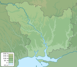
Village in Mykolaiv Oblast, Ukraine
| Barativka Баратівка | |
|---|---|
| Village | |
  | |
| Coordinates: 46°56′46″N 32°46′52″E / 46.946111°N 32.781111°E / 46.946111; 32.781111 | |
| Country | |
| Oblast | Mykolaiv Oblast |
| Raion | Bashtanka Raion |
| Founded | 1864 |
| Elevation | 15 m (49 ft) |
| Population | |
| • Total | 1,088 |
| Time zone | UTC+2 (EET) |
| • Summer (DST) | UTC+3 (EEST) |
| Postal code | 57370 |
| Area code | +380 5162 |
Barativka (Ukrainian: Баратівка; Russian: Баратовка) is a village in Bashtanka Raion (district) in Mykolaiv Oblast of southern Ukraine, at about 50 kilometres (31 mi) east from the centre of Mykolaiv city. It belongs to Horokhivske rural hromada, one of the hromadas of Ukraine.
Until 18 July 2020, Barativka belonged to Snihurivka Raion. The raion was abolished that day as part of the administrative reform of Ukraine, which reduced the number of raions of Mykolaiv Oblast to four. The area of Snihurivka Raion was merged into Bashtanka Raion.
The village was occupied by Russian forces in 2022, during the Russian invasion of Ukraine.
References
- "Distribution of the population by native language on ukrcensus.gov.ua". Retrieved 26 September 2022.
- "Гороховская громада" (in Russian). Портал об'єднаних громад України.
- "Про утворення та ліквідацію районів. Постанова Верховної Ради України № 807-ІХ". Голос України (in Ukrainian). 18 July 2020. Retrieved 3 October 2020.
- "Нові райони: карти + склад" (in Ukrainian). Міністерство розвитку громад та територій України.
- "Interactive Map: Russia's Invasion of Ukraine". ArcGIS StoryMaps. 9 August 2022. Retrieved 9 August 2022.