| Basy Басы | |
|---|---|
| Selo | |
 | |
  | |
| Coordinates: 46°07′N 47°08′E / 46.117°N 47.133°E / 46.117; 47.133 | |
| Country | Russia |
| Region | Astrakhan Oblast |
| District | Limansky District |
| Time zone | UTC+4:00 |
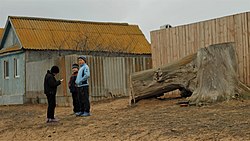
Basy (Russian: Басы) is a rural locality (a selo) and the administrative center of Basinsky Selsoviet, Limansky District, Astrakhan Oblast, Russia. The population was 997 as of 2010. There are 19 streets.
Demographics
Ethnic composition
As of 2002, ethnic Russians and Chechens were the two largest groups in the village.
| Ethnicity | Number | Percentage |
|---|---|---|
| Russians | 592 | 47,4% |
| Chechens | 397 | 31,79% |
| Dargins | 91 | 7,29% |
| Kazakhs | 89 | 7,13% |
| Kalmyks | 41 | 3,28% |
| Kumyks | 16 | 1,28% |
| Nogais | 12 | 0,96% |
| Mari | 4 | 0,32% |
| Germans | 4 | 0,32% |
| Ukrainians | 3 | 0,24% |
| Total | 1249 | 100% |
Geography
Basy is located 45 km north of Liman (the district's administrative centre) by road. Basinsk is the nearest rural locality.
References
- Карта села Басы в Астраханской области
- "Всероссийская перепись населения 2010 года. 1. Численность и размещение населения Астраханской области" (PDF). Archived from the original (PDF) on 2018-08-27. Retrieved 2019-03-21.
- Tim Bespyatov. "Astrakhan Oblast (2002)". Population statistics of Eastern Europe & former USSR. Retrieved 2020-08-04.
- Расстояние от Бас до Лимана
| Rural localities in Limansky District | |||
|---|---|---|---|
This Astrakhan Oblast location article is a stub. You can help Misplaced Pages by expanding it. |