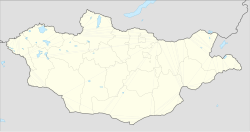
| Bayanbulag District
Mongolian: Баянбулаг сум ᠪᠠᠶ᠋ᠠᠨᠪᠤᠯᠠᠭᠰᠤᠮᠤ | |
|---|---|
| District | |
 | |
| Coordinates: 46°48′29″N 98°05′28″E / 46.80806°N 98.09111°E / 46.80806; 98.09111 | |
| Country | Mongolia |
| Province | Bayankhongor |
| Area | |
| • Total | 1,220 sq mi (3,170 km) |
| Time zone | UTC+8 |
Bayanbulag (Mongolian: Баянбулаг, rich spring) is a sum (district) of Bayankhongor Province in southern Mongolia. In 2006, its population was 2,143.
Climate
Bayanbulag has a cold semi-arid climate (Köppen climate classification BSk) with mild summers and severely cold winters. The climate is very dry; most precipitation falls in the summer as rain, with some snow in the adjacent months of May and September. Winters are very dry.
| Climate data for Bayanbulag (1981-2010 normals, extremes 1975-2020) | |||||||||||||
|---|---|---|---|---|---|---|---|---|---|---|---|---|---|
| Month | Jan | Feb | Mar | Apr | May | Jun | Jul | Aug | Sep | Oct | Nov | Dec | Year |
| Record high °C (°F) | 4.0 (39.2) |
6.4 (43.5) |
13.7 (56.7) |
23.2 (73.8) |
27.9 (82.2) |
29.3 (84.7) |
32.7 (90.9) |
28.6 (83.5) |
23.8 (74.8) |
19.6 (67.3) |
10.6 (51.1) |
7.8 (46.0) |
32.7 (90.9) |
| Mean daily maximum °C (°F) | −12.5 (9.5) |
−8.9 (16.0) |
−2.9 (26.8) |
5.7 (42.3) |
13.5 (56.3) |
18.9 (66.0) |
20.6 (69.1) |
18.4 (65.1) |
12.9 (55.2) |
4.7 (40.5) |
−4.9 (23.2) |
−11.0 (12.2) |
4.5 (40.2) |
| Daily mean °C (°F) | −22.3 (−8.1) |
−18.9 (−2.0) |
−11.8 (10.8) |
−2.1 (28.2) |
5.7 (42.3) |
11.3 (52.3) |
13.4 (56.1) |
10.9 (51.6) |
4.6 (40.3) |
−3.9 (25.0) |
−13.5 (7.7) |
−19.9 (−3.8) |
−3.8 (25.2) |
| Mean daily minimum °C (°F) | −29.9 (−21.8) |
−27.4 (−17.3) |
−20.7 (−5.3) |
−10.2 (13.6) |
−2.6 (27.3) |
3.0 (37.4) |
6.0 (42.8) |
3.2 (37.8) |
−3.6 (25.5) |
−11.8 (10.8) |
−21.0 (−5.8) |
−27.1 (−16.8) |
−11.8 (10.7) |
| Record low °C (°F) | −48.1 (−54.6) |
−45.0 (−49.0) |
−40.2 (−40.4) |
−35.4 (−31.7) |
−23.8 (−10.8) |
−11.4 (11.5) |
−7.8 (18.0) |
−9.0 (15.8) |
−17.3 (0.9) |
−29.9 (−21.8) |
−40.4 (−40.7) |
−45.5 (−49.9) |
−48.1 (−54.6) |
| Average precipitation mm (inches) | 1.1 (0.04) |
1.4 (0.06) |
4.7 (0.19) |
4.2 (0.17) |
8.8 (0.35) |
28.0 (1.10) |
46.5 (1.83) |
32.5 (1.28) |
11.1 (0.44) |
4.1 (0.16) |
1.9 (0.07) |
1.3 (0.05) |
145.8 (5.74) |
| Average precipitation days (≥ 1 mm) | 0.4 | 0.3 | 0.9 | 0.9 | 1.7 | 3.8 | 6.1 | 4.9 | 2.1 | 1.2 | 0.7 | 0.4 | 23.0 |
| Average rainy days | 0.0 | 0.0 | 0.0 | 0.0 | 4.9 | 7.9 | 11.3 | 8.9 | 4.5 | 0.0 | 0.0 | 0.0 | 37.6 |
| Average snowy days | 2.4 | 2.3 | 4.0 | 4.6 | 2.0 | 0.0 | 0.0 | 0.0 | 0.0 | 3.5 | 3.2 | 2.8 | 24.9 |
| Average relative humidity (%) | 63 | 57 | 54 | 49 | 41 | 42 | 49 | 56 | 49 | 58 | 62 | 65 | 54 |
| Source 1: NOAA | |||||||||||||
| Source 2: Office of Meteorology and Environmental Analysis (precipitation and extremes 1991-2020) | |||||||||||||
References
- "Bayankhongor Aimag Statistical Office 2006 annual report: population" (PDF). Archived from the original (PDF) on May 28, 2008.
- "Mongolia Climate Normals 1981-2010". National Oceanic and Atmospheric Administration. Retrieved February 5, 2023.
- "Aayanbulag Climate Normals 1961-1990". National Oceanic and Atmospheric Administration. Retrieved January 13, 2013.
- "САР, ЖИЛИЙН НИЙЛБЭР ХУР ТУНАДАС". Office of Meteorology and Environmental Analysis. Retrieved February 5, 2023.
- "АГААРЫН ҮНЭМЛЭХҮЙ ИХ ТЕМПЕРАТУР". Office of Meteorology and Environmental Analysis. Retrieved February 5, 2023.
- "АГААРЫН ҮНЭМЛЭХҮЙ БАГА ТЕМПЕРАТУР". Office of Meteorology and Environmental Analysis. Retrieved February 5, 2023.
| Districts of Bayankhongor | ||
|---|---|---|
This Mongolia location article is a stub. You can help Misplaced Pages by expanding it. |