| Beinn Bharrain | |
|---|---|
 Beinn Bharrain seen from Beinn Tarsuinn Beinn Bharrain seen from Beinn Tarsuinn | |
| Highest point | |
| Elevation | 721 m (2,365 ft) |
| Prominence | 380 m (1,250 ft) |
| Listing | Graham, Marilyn |
| Coordinates | 55°37′59″N 5°20′06″W / 55.6331°N 5.3350°W / 55.6331; -5.3350 |
| Geography | |
| Location | Isle of Arran, Scotland |
| Parent range | Northwest Highlands |
| OS grid | NR902428 |
| Topo map | OS Landranger 62, 69 |
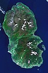
Beinn Bharrain (721 m) is a mountain on the Isle of Arran, Scotland, located in the far northwest of the Island.
Despite being less frequently visited than its eastern neighbours, it still provides fine views from the top. The entire hill is known as Beinn Bharrain, with 'Mullach Buidhe' the highest of its summits.
References
- "Beinn Bharrain". hill-bagging.co.uk. Retrieved 25 October 2019.
- "walkhighlands Beinn Bharrain". walkhighlands.co.uk. Retrieved 25 October 2019.
| Isle of Arran | ||
|---|---|---|
| Main villages |  | |
| Smaller villages and settlements | ||
| Mountains and hills | ||
| History |
| |
| Environment | ||
| Economy | ||
| Surrounding islands | ||
This North Ayrshire location article is a stub. You can help Misplaced Pages by expanding it. |