| Beljina Бељина | |
|---|---|
| Suburban settlement | |
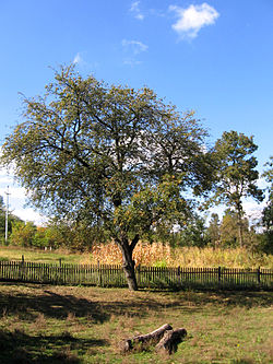
 A tree in Beljina A tree in Beljina | |
 | |
| Coordinates: 44°31′12″N 20°23′44″E / 44.52000°N 20.39556°E / 44.52000; 20.39556 | |
| Country | |
| City | Belgrade |
| Municipality | Barajevo |
| Area | |
| • Total | 10.11 km (3.90 sq mi) |
| Population | |
| • Total | 775 |
| Time zone | UTC+1 (CET) |
| • Summer (DST) | UTC+2 (CEST) |
| Area code | 011 |
| Vehicle registration | BG |
| RZS code | 703516 |
Beljina (Serbian Cyrillic: Бељина) is a suburban settlement of Belgrade, Serbia. It is located in the municipality of Barajevo. Beljina is a small rural settlement with 775 inhabitants as of 2011, located on the northeastern tip of the Kosmaj mountain, 12 km south of the municipal seat of Barajevo. In 1956 the municipality of Beljina was created, comprising villages of Beljina, Arnajevo, Manić and Rožanci, but already in 1957 the municipality was dissolved and annexed to the municipality of Barajevo.
Old section of the village, known as Čaršija in Beljina [sr], is placed under the state protection as the spatial cultural-historical unit.
Demographics
In 2011, the settlement contained 270 households with an average of 2.87 members. There were 228 families, with 87% of the population being adults and an average age of 46.2.
Wildlife
By the 21st century, number of migratory European rollers in Serbia was reduced to some 20 nesting couples, where only few were recorded in Central Serbia and none in the central Šumadija region. The species was widespread by the mid-20th century, but was protected by the state in 1993. In order to try to repopulate the species, ornithologists placed bird houses on top of the trees in Beljina in 2015, but the attempt was unsuccessful. In 2017 the bird houses was moved to the village's utility poles, and rollers began nesting again, starting in 2018, in slowly growing numbers each year.
| Year | Pop. | ±% |
|---|---|---|
| 1948 | 977 | — |
| 1953 | 980 | +0.3% |
| 1961 | 954 | −2.7% |
| 1971 | 883 | −7.4% |
| 1981 | 892 | +1.0% |
| 1991 | 873 | −2.1% |
| 2002 | 810 | −7.2% |
| 2011 | 775 | −4.3% |
| Source: | ||
References
- "Насеља општине Барајево" (PDF). stat.gov.rs (in Serbian). Statistical Office of Serbia. Archived from the original (PDF) on 14 November 2015. Retrieved 22 October 2019.
- ^ "Population by age and sex, by settlements". Statistical Office for the Republic of Serbia. Archived from the original on 2017-10-16. Retrieved 2017-05-20.
- "Register of Territorial Units and GIS". Statistical Office for the Republic of Serbia.
- Branka Vasiljević (13 September 2021). "U planu da se pod zaštitu stavi osam prostornih celina" [Plan for placing eight spatial units under protection]. Politika (in Serbian). p. 15.
- Branka Vasiljević (28 May 2020). "Jedna od najlepših ptica živi u Barajevu" [One of the most beautiful birds lives in Barajevo]. Politika (in Serbian). p. 14.
- "Comparative overview of the number of population in 1948, 1953, 1961, 1971, 1981, 1991, 2002 and 2011". Statistical Office for the Republic of Serbia. Archived from the original on 2017-10-16. Retrieved 2017-05-20.
This Belgrade District, Serbia location article is a stub. You can help Misplaced Pages by expanding it. |