| This article needs additional citations for verification. Please help improve this article by adding citations to reliable sources. Unsourced material may be challenged and removed. Find sources: "Big Bureau Creek" – news · newspapers · books · scholar · JSTOR (April 2007) (Learn how and when to remove this message) |
| Big Bureau Creek | |
|---|---|
 a rough area of Big Bureau Creek a rough area of Big Bureau Creek | |
| Location | |
| Country | United States |
| State | Illinois |
| Physical characteristics | |
| Source | |
| • location | Near Compton, Lee County, Illinois |
| • coordinates | 41°42′00″N 89°04′11″W / 41.70000°N 89.06972°W / 41.70000; -89.06972 |
| Mouth | Illinois River |
| • location | South of Bureau, Bureau County, Illinois |
| • coordinates | 41°14′53″N 89°22′27″W / 41.24806°N 89.37417°W / 41.24806; -89.37417 |
| Length | 73 mi (117 km) |
The Big Bureau Creek is a 73-mile-long (117 km) tributary of the Illinois River in north central Illinois. It rises approximately 10 miles (16 km) north of Mendota and flows southwest into Bureau County, turning south at Princeton and then flowing east into the Illinois River floodplain. Among the creek's more notable features is the Red Covered Bridge, built in 1863, which passes over Big Bureau Creek and was once part of the Peoria Galena Trail. The bridge, located just north of Interstate 80, is listed on the National Register of Historic Places.
Ecology

Currently, there is an effort underway to maintain this watershed as well to evaluate its current condition with the Big Bureau Creek Watershed Inventory and Evaluation (I&E) begun in 2003 (See the Forward and Acknowledgment section for the year 2003). Nitrogen levels from surrounding farmland, sedimentation, and low water levels are the main problems to be assessed.
History
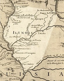
The stream is named for Michel or Pierre Bureau. Their original surname was probably Belleau, but local aboriginals may have had difficulty pronouncing the "l" sound. One or both of the brothers ran a trading post near where Big Bureau Creek empties into the Illinois River from 1776 until 1780 or 1790. The stream was called the Chassagauch", "Chassagoach", or "Chachagouche" River on early maps of the region. These are European renderings of the Miami-Illinois language word šaahšaakweehsiiwa, which once meant 'copperhead' (agkistrodon contortrix) but now means 'garter snake'. Šaahšaakweehsiiwa was also the name of a chief and diplomat of the Kaskaskia at the Grand Village of the Illinois, up river from Starved Rock, in the late 17th and early 18th centuries.
Recreation

Most land surrounding the banks of the Big Bureau Creek is privately owned. Canoeing on the creek is possible in some areas. There have been reports of class II and III rapids in high water. Brush buildup, beaver dams, and submerged rocks are always a point of concern.
References
- ^ U.S. Geological Survey. National Hydrography Dataset high-resolution flowline data. The National Map Archived 2012-03-29 at the Wayback Machine, accessed May 26, 2011
- U.S. Geological Survey Geographic Names Information System: Big Bureau Creek
- "National Register Information System". National Register of Historic Places. National Park Service. July 9, 2010.
- ftp://199.133.90.201/pub/outgoing/Downloads/IL_Big_Bureau_Creek/Big_Bureau_Creek_Watershed_Inventory.pdf
- Pierre de Beuro, an Indian trader Pioneers of Illinois by Nehemiah Matson, 1882, p. 229
- Jean Baptiste Point de Sable : the founder of modern Chicago Archived 2005-01-16 at the Wayback Machine by John F. Swenson, 1999- . Retrieved 11 November 2010.
- Carte de la Louisiane ou des voyages du Sr. De La Salle by Jean Baptiste Louis Franquelin, 1684. Retrieved 14 September 2010.
- Carte de l'Amerique Septentrionnale by Jean Baptiste Louis Franquelin, 1688. Retrieved 14 September 2010.
- Carte de la Louisiane et du cours du Mississipi by Guillaume de l'Isle, 1718. Retrieved 14 September 2010.
- Native American place names of Indiana by Michael McCafferty, University of Illinois Press, 2008, p. 24. Retrieved 4 August 2010.
- "Shall Indian languages be preserved?" by Jacob Piatt Dunn, Journal of the Illinois State Historical Society, Vol. 10, No. 1 (Apr. 1917), p. 91. Retrieved 4 August 2010.
- Chachagouesse, Dictionary of Canadian biography online. Retrieved 4 August 2010.