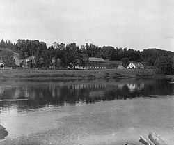
Place in New Brunswick, Canada
| Blackville | |
|---|---|
 | |
 | |
| Coordinates: 46°44′06″N 65°49′45″W / 46.73507°N 65.82918°W / 46.73507; -65.82918 | |
| Country | Canada |
| Province | New Brunswick |
| County | Northumberland |
| Parish | Blackville |
| Municipality | Miramichi River Valley |
| Incorporated | 1967 |
| Amalgamated | 2023 |
| Government | |
| • Type | Mayor and Council of Miramichi River Valley Rural Community |
| Area | |
| • Total | 20.97 km (8.10 sq mi) |
| Population | |
| • Total | 914 |
| • Density | 43.6/km (113/sq mi) |
| • Change 2016–21 | |
| Time zone | UTC-4 (EST) |
| • Summer (DST) | UTC-3 (EDT) |
| Website | www |
Blackville is a former village in Northumberland County, New Brunswick, Canada. It is now part of the rural community of Miramichi River Valley.
It is located on the Southwest Miramichi River approximately 40 km (25 mi) southwest of Miramichi.
History
See also: History of New Brunswick and List of historic places in Northumberland County, New BrunswickThe first post office opened in the area in 1842, under the community name "Decantillon's"; the area known as The Forks was also serviced by this post office. In 1847, these areas collectively became known as Blackville, as the area was the largest population centre in the Parish of Blackville. The parish, created in 1830 when it was partitioned from the Parish of Ludlow, had been named in honour of William Black, the acting governor of the colony of New Brunswick from 1829 to 1831.
Blackville was first incorporated as a village in 1967, annexing the neighbouring communities of Underhill and Breadalbane later that year.
On January 1, 2023, Blackville amalgamated with all or part of eight local service districts to form the new incorporated rural community of Miramichi River Valley. Blackville remains in official use.
Demographics
In the 2021 Census of Population conducted by Statistics Canada, Blackville had a population of 914 living in 394 of its 446 total private dwellings, a change of -4.6% from its 2016 population of 958. With a land area of 20.97 km (8.10 sq mi), it had a population density of 43.6/km (112.9/sq mi) in 2021.
| Year | Pop. | ±% |
|---|---|---|
| 1871 | 450 | — |
| 1898 | 600 | +33.3% |
| 1981 | 892 | +48.7% |
| 1986 | 903 | +1.2% |
| 1991 | 938 | +3.9% |
| 1996 | 957 | +2.0% |
| 2001 | 1,015 | +6.1% |
| 2006 | 931 | −8.3% |
| 2011 | 990 | +6.3% |
| 2016 | 958 | −3.2% |
| 2021 | 914 | −4.6% |
| Source: | ||
Government
Blackville residents are able to cast votes in the Miramichi River Valley Rural Community's elections for mayor, three at-large councillors, and the Ward 3 councillor. The community is within the federal electoral district of Miramichi-Grand Lake, and within the provincial electoral district of Southwest Miramichi-Bay du Vin.
The mayors of Blackville during its time as an incorporated village from 1967 to 2022 included:
- Lawrence Stephens (1967–1969)
- Harold Connors (1969–1971)
- Roland Walls (1971–1992)
- Glen Hollowood (1992–1998)
- Roland Walls (1998–2001)
- Omer MacKenzie (2001–2004)
- Glen Hollowood (2004–2012)
- Harold Muck (2012–2013)
- Matthew Sturgeon (2013)
- Andrew Hawkes (2013–2016)
- Christopher Hennessy (2016–2021)
- Ian Fortune (2021–2022)
Economy
Blackville's economy was once tied to the forest industry. A large sawmill that employed 200 workers had been operated in the village by industrial conglomerate UPM Kymmene, but it closed in 2007 as a result of economic pressures.
According to the 2016 Census, Blackville citizens had a median income of $30,816 for individuals, and $62,976 for households in 2015. Blackville's unemployment rate was 21.9%.
Blackville is home to a single financial institution, Blackville Credit Union. It is the oldest of its kind in New Brunswick.
Education
Blackville School, grades K–12, is a public school in the community. This is the only grade school in Blackville, with students occasionally transporting to other Miramichi schools instead (Such as Miramichi Valley High School).
Notable people
Main article: List of people from Northumberland County, New Brunswick- Herb Curtis
- J. F. A. McManus
- Kathy McCormack
- Marion Leane Smith (Lived her final years and died in Blackville.)
See also
References
- ^ "Census Profile of Blackville". Statistics Canada. December 6, 2022. Retrieved January 11, 2023.
- "Local Governments Establishment Regulation – Local Governance Act". Government of New Brunswick. October 12, 2022. Retrieved January 20, 2023.
- "RSC 5 Greater Miramichi Regional Service Commission". Government of New Brunswick. Retrieved January 17, 2023.
- "Proposed entity names reflect strong ties to nature and history" (Press release). Irishtown, New Brunswick: Government of New Brunswick. May 25, 2022. Retrieved January 20, 2023.
- "Population and dwelling counts: Canada, provinces and territories, census divisions and census subdivisions (municipalities), New Brunswick". Statistics Canada. February 9, 2022. Retrieved February 21, 2022.
- Statistics Canada 2006 Community Profiles: Blackville, New Brunswick
- ^ "Census Profile, 2016 Census: Blackville, Village [Census subdivision], New Brunswick". Statistics Canada. February 8, 2017. Retrieved September 24, 2019.
- "Municipal, Education and Health Elections Publications". February 28, 2014.
External links
| Subdivisions of New Brunswick | |
|---|---|
| Cities | |
| Towns |
|
| Villages | |
| Regional municipality | |
| Rural communities | |
| Rural districts |
|
| Regional service commissions | |
| School districts | |
| Indian reserves |
|
| Non-administrative divisions | |