| This article includes a list of general references, but it lacks sufficient corresponding inline citations. Please help to improve this article by introducing more precise citations. (March 2013) (Learn how and when to remove this message) |
| Bleiswijk | |
|---|---|
| Village | |
 Nederlands Hervormde Kerk Nederlands Hervormde Kerk | |
 Flag Flag Seal Seal | |
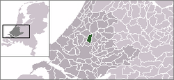
 Location in South Holland Location in South Holland | |
 | |
| Coordinates: 52°01′N 4°32′E / 52.01°N 4.54°E / 52.01; 4.54 | |
| Country | |
| Province | |
| Municipality | |
| Area | |
| • Total | 21.96 km (8.48 sq mi) |
| • Land | 21.13 km (8.16 sq mi) |
| • Water | 0.84 km (0.32 sq mi) |
| Population | |
| • Total | 10,895 |
| • Density | 500/km (1,300/sq mi) |
| Time zone | UTC+1 (CET) |
| • Summer (DST) | UTC+2 (CEST) |
| Postal code | 2665 |
| Area code | 010 |
| Major roads | N209 |
Bleiswijk (Dutch: [ˈblɛisʋɛik] ) is a town and former municipality in the western Netherlands, in the province of South Holland.
Demographics
The municipality had a population of 10,222 in 2006, and covered an area of 21.96 km (8.48 sq mi) of which 0.83 km (0.32 sq mi) is water. On 1 January 2007, the town was merged with neighbouring towns Bergschenhoek and Berkel en Rodenrijs to form the new municipality Lansingerland.
According to the January 2020 census, its population was 10,895.
References
- "Kerncijfers wijken en buurten 2020" (in Dutch). CBS. Retrieved November 13, 2020.
External links
| Populated places in the municipality of Lansingerland | |
|---|---|
| Villages | |
| Hamlets | |
| List of cities, towns and villages in South Holland | |
This South Holland location article is a stub. You can help Misplaced Pages by expanding it. |