Town in Florida, United States
| Branford, Florida | |
|---|---|
| Town | |
| Town of Branford | |
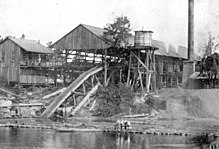
 Top, left to right: Downtown Branford, Suwannee River, Branford Town Hall, Branford Water Tower Top, left to right: Downtown Branford, Suwannee River, Branford Town Hall, Branford Water Tower | |
| Motto(s): "On the Banks of the Suwannee River" "Spring Diving Capital of the World" "In God We Trust" | |
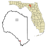
 Location in Suwannee County and the state of Florida Location in Suwannee County and the state of Florida | |
| Coordinates: 29°57′42″N 82°55′38″W / 29.96167°N 82.92722°W / 29.96167; -82.92722 | |
| Country | |
| State | |
| County | Suwannee |
| Settled (Rowland's Bluff-New Branford Settlement) | 1886 |
| Incorporated | 1961 |
| Government | |
| • Type | Mayor-Council |
| • Mayor | Donny Glover |
| • Council President | Ken Saunders |
| • Councilors | Alice Childress, Charlie Daniel, Stacey Griffith, and Jay Hatch |
| • Town Clerk | Aleshia Terry |
| • Town Attorney | Rhett Bullard |
| Area | |
| • Total | 1.14 sq mi (2.94 km) |
| • Land | 1.14 sq mi (2.94 km) |
| • Water | 0.00 sq mi (0.00 km) |
| Elevation | 39 ft (12 m) |
| Population | |
| • Total | 711 |
| • Density | 625.88/sq mi (241.72/km) |
| Time zone | UTC-5 (Eastern (EST)) |
| • Summer (DST) | UTC-4 (EDT) |
| ZIP code | 32008 |
| Area code | 386 |
| FIPS code | 12-08175 |
| GNIS feature ID | 0279335 |
| Website | townofbranford |
Branford is a town in Suwannee County, Florida, United States. The Town of Branford was officially incorporated as a municipality in 1961, although it has been settled since 1882, and was first incorporated in 1886. The original name was Rowland’s Bluff in the 1870’s when the town consisted of a sawmill and a Ferry Crossing across the Suwannee River into Lafayette County. The railroad was extended by Henry B. Plant from Live Oak to Branford in 1882, and the town was named New Branford after Branford, Connecticut, Henry Plant’s hometown. Later the New was dropped. The town was largely destroyed by a hurricane in 1896, being rebuilt right after. The population was 711 at the 2020 census.

Geography
The exact coordinates for the Town of Branford is located at 29°57′42″N 82°55′38″W / 29.96167°N 82.92722°W / 29.96167; -82.92722 (29.961803, –82.927204).
The town is located on the banks of the Suwannee River. U.S. Route 27 and U.S. Highway 129 intersect in Branford.
According to the United States Census Bureau, the town has a total area of 0.8 square miles (2.1 km), all land.
Climate
The climate in this area is characterized by hot, humid summers and generally mild winters. According to the Köppen climate classification, the Town of Branford has a humid subtropical climate zone (Cfa).
Demographics
| Census | Pop. | Note | %± |
|---|---|---|---|
| 1890 | 335 | — | |
| 1910 | 26 | — | |
| 1920 | 708 | 2,623.1% | |
| 1930 | 498 | −29.7% | |
| 1940 | 684 | 37.3% | |
| 1950 | 753 | 10.1% | |
| 1960 | 663 | −12.0% | |
| 1970 | 820 | 23.7% | |
| 1980 | 622 | −24.1% | |
| 1990 | 670 | 7.7% | |
| 2000 | 695 | 3.7% | |
| 2010 | 712 | 2.4% | |
| 2020 | 711 | −0.1% | |
| U.S. Decennial Census | |||
2010 and 2020 census
| Race | Pop 2010 | Pop 2020 | % 2010 | % 2020 |
|---|---|---|---|---|
| White (NH) | 525 | 524 | 73.74% | 73.70% |
| Black or African American (NH) | 49 | 35 | 6.88% | 4.92% |
| Native American or Alaska Native (NH) | 6 | 3 | 0.84% | 0.42% |
| Asian (NH) | 12 | 8 | 1.69% | 1.13% |
| Pacific Islander or Native Hawaiian (NH) | 5 | 0 | 0.70% | 0.00% |
| Some other race (NH) | 6 | 1 | 0.84% | 0.14% |
| Two or more races/Multiracial (NH) | 15 | 30 | 2.11% | 4.22% |
| Hispanic or Latino (any race) | 94 | 110 | 13.20% | 15.47% |
| Total | 712 | 711 | 100.00% | 100.00% |
As of the 2020 United States census, there were 711 people, 323 households, and 175 families residing in the town.
As of the 2010 United States census, there were 712 people, 345 households, and 235 families residing in the town.
2000 census
As of the census of 2000, there were 695 people, 270 households, and 170 families resided in the town. The population density is 323.3 people/km (837 people/sq mi). There were 320 housing units at an average density of 148.9 units/km (386 units/sq mi). The racial makeup of the town was 87.05% White, 7.05% African American, 0.29% Native American, 0.29% Asian, 0.00% Pacific Islander, 2.73% from other races, and 2.59% from two or more races. 9.50% of the population were Hispanic or Latino of any race.
In 2000, there were 270 households out of which 33.0% had children under the age of 18 living with them, 42.2% were married couples living together, 15.6% had a female householder with no husband present, and 36.7% were non-families. 31.1% of all households were made up of individuals and 17.4% had someone living alone who was 65 years of age or older. The average household size was 2.53 and the average family size was 3.15.
In 2000, in the town the population was spread out with 27.6% under the age of 18, 9.8% from 18 to 24, 28.1% from 25 to 44, 20.6% from 45 to 64, and 14.0% who were 65 years of age or older. The median age was 33 years. For every 100 females there were 90.9 males. For every 100 females age 18 and over, there were 95.7 males.
In 2000, the median income for a household in the town was $24,286, and the median income for a family was $31,705. Males had a median income of $24,583 versus $18,750 for females. The per capita income for the town was $12,716. 21.0% of the population and 13.8% of families were below the poverty line. Out of the total people living in poverty, 17.2% were under the age of 18 and 26.4% are 65 or older.
Education
The public schools within the Town of Branford is served by the Suwannee County School District.
- Branford Elementary School
- Branford High School
Library
The Branford Library is served by the Suwannee River Regional Library System, which contains eight branches and also serves Hamilton and Madison counties.
It is open 6 days per week on Suwannee Avenue.
Branford Springs
On the Suwannee River, Branford Springs within the town is a popular diving spot.
See also
References
- ^ "OUR HISTORY: HISTORY OF SUWANNEE COUNTY". www.suwanneechamber.com.
- ^ "FLORIDA CITIES BY INCORPORATION YEAR WITH INCORPORATION & DISSOLUTION INFO" (PDF). www.flcities.com.
- "2020 U.S. Gazetteer Files". United States Census Bureau. Retrieved October 31, 2021.
- ^ U.S. Geological Survey Geographic Names Information System: Branford, Florida
- ^ "U.S. Census website". United States Census Bureau. Retrieved January 31, 2008.
- "US Gazetteer files: 2010, 2000, and 1990". United States Census Bureau. February 12, 2011. Retrieved April 23, 2011.
- "Census of Population and Housing". Census.gov. Retrieved June 4, 2015.
- "P2 HISPANIC OR LATINO, AND NOT HISPANIC OR LATINO BY RACE - 2010: DEC Redistricting Data (PL 94-171) - Branford town, Florida". United States Census Bureau.
- "P2 HISPANIC OR LATINO, AND NOT HISPANIC OR LATINO BY RACE - 2020: DEC Redistricting Data (PL 94-171) - Branford town, Florida". United States Census Bureau.
- "S1101 HOUSEHOLDS AND FAMILIES - 2020: Branford town, Florida". United States Census Bureau.
- "S1101 HOUSEHOLDS AND FAMILIES - 2010: Branford town, Florida". United States Census Bureau.
- "Branford Springs". underwaterflorida. Retrieved May 18, 2012.
- "Branford Springs". apalacheehills.com. Archived from the original on September 1, 2012. Retrieved May 18, 2012.
External links
| Municipalities and communities of Suwannee County, Florida, United States | ||
|---|---|---|
| County seat: Live Oak | ||
| City |  | |
| Town | ||
| Unincorporated communities | ||


