| Brustury
Брустури Brusztura | |
|---|---|
| Village | |
 | |
  | |
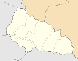
| Coordinates: 48°21′49″N 23°57′59″E / 48.36361°N 23.96639°E / 48.36361; 23.96639 | |
| Country | Ukraine |
| Oblast | Zakarpattia Oblast |
| Raion | Tiachiv Raion |
| Elevation | 599 m (1,965 ft) |
| Population | |
| • Total | 3,317 |
| Time zone | UTC+2 (EET) |
| • Summer (DST) | UTC+3 (EEST) |
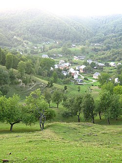
Brustury (Ukrainian: Брустури; Hungarian: Brusztura), known before 2023 as Lopukhiv (Ukrainian: Лопухів), is a village in Tiachiv Raion of Zakarpattia Oblast in Ukraine.
History
The village was first mentioned in 1638, when the village was called Brusztura. It comes from the Romanian word "brustur", meaning heart-shaped comfrey.
After it was incorporated into the Ukrainian SSR as part of the Ukrainianization of the Carpathians, the village was renamed Lopukhiv.
On June 29, 2023, the Verkhovna Rada officially renamed the village to Brustury as part of the derussification in Ukraine.
Geography
Brustury is located on both sides of the river Brusturyanka, 67 km (42 mi) from the district center Tiachiv.
Demographics
Native language as of the Ukrainian Census of 2001:
- Ukrainian 99.64%
- Others 0.36%
References
- "Про перейменування села Лопухів Тячівського району Закарпатської області". Verkhovna Rada (in Ukrainian). Retrieved 2023-11-02.
- Бєлоусов, В.І. (1969). Історія міст і сіл Української РСР (in Ukrainian). Кyiv: Головна редакція української радянської енциклопедії АН УРСР. p. 646.
- Розподіл населення за рідною мовою на ukrcensus.gov.ua Archived 31 July 2014 at the Wayback Machine
This article about a location in Zakarpattia Oblast is a stub. You can help Misplaced Pages by expanding it. |