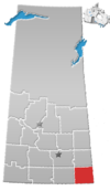
Unincorporated community in Saskatchewan, Canada
| Bryant | |
|---|---|
| Unincorporated community | |
 | |
| Coordinates: 49°20′53″N 102°59′35″W / 49.3481°N 102.99316°W / 49.3481; -102.99316 | |
| Country | Canada |
| Province | Saskatchewan |
| Region | Southeast Saskatchewan |
| Census division | 1 |
| Rural Municipality | Benson |
| Established | 1911 |
| Government | |
| • Reeve | David Hoffort |
| • Administrator | Laureen Keating |
| • Governing body | Benson No. 35 |
| Time zone | CST |
| Postal code | S0C 0L0 |
| Area code | 306 |
| Highways | |
Bryant is an unincorporated community in Benson Rural Municipality No. 35, Saskatchewan, Canada. The community is located on Highway 702, approximately 20 km (12 mi) west of Lampman and 20 km (12 mi) north of Estevan. Bryant gets its name from Quaker poet, journalist, and editor William Cullen Bryant.
See also
References
- National Archives, Archivia Net, Post Offices and Postmasters, archived from the original on October 6, 2006
- Government of Saskatchewan, MRD Home, Municipal Directory System, archived from the original on November 21, 2008
- Canadian Textiles Institute. (2005), CTI Determine your provincial constituency, archived from the original on September 11, 2007
- Commissioner of Canada Elections, Chief Electoral Officer of Canada (2005), Elections Canada On-line, archived from the original on April 21, 2007
- "Bryant_bryantindex.HTML -".
| Places adjacent to Bryant, Saskatchewan | ||||||||||||||||
|---|---|---|---|---|---|---|---|---|---|---|---|---|---|---|---|---|
| ||||||||||||||||
| Division No. 1, Saskatchewan | |||||
|---|---|---|---|---|---|
| Cities |  | ||||
| Towns | |||||
| Villages | |||||
| Rural municipalities | |||||
| First Nations | |||||
| Indian reserves | |||||
| Unincorporated communities |
| ||||
|
| |||||
49°20′53″N 102°59′35″W / 49.348°N 102.993°W / 49.348; -102.993
This article about a location in the Census Division No. 1 of Saskatchewan is a stub. You can help Misplaced Pages by expanding it. |