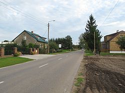
| Brzozowo | |
|---|---|
| Village | |
 | |
 | |
| Coordinates: 53°37′43″N 23°21′35″E / 53.62861°N 23.35972°E / 53.62861; 23.35972 | |
| Country | |
| Voivodeship | Podlaskie |
| County | Sokółka |
| Gmina | Dąbrowa Białostocka |
| Area | |
| • Total | 7.06 km (2.73 sq mi) |
| Population | |
| • Total | 226 |
| • Density | 32.01/km (82.9/sq mi) |
| Time zone | UTC+1 (CET) |
| • Summer (DST) | UTC+2 (CEST) |
| Postal code | 16-200 |
| Area code | +48 85 |
| Car plates | BSK |
| SIMC | 0026442 |
Brzozowo is a village in northeast Poland in the gmina of Dąbrowa Białostocka, Sokółka County, Podlaskie Voivodeship. As of 2021, it had a population of 226.
Population
| Year | Pop. | ±% p.a. |
|---|---|---|
| 1988 | 275 | — |
| 2002 | 245 | −0.82% |
| 2011 | 243 | −0.09% |
| 2021 | 226 | −0.72% |
| Source: GUS | ||
References
- "TERYT Register" (in Polish). Statistics Poland. Retrieved 4 February 2024.
- "Geoportal e-mapa" (in Polish). Geo-System. Retrieved 4 February 2024.
- ^ "Local Data Bank" (in Polish). Statistics Poland. Retrieved 4 February 2024.
This Sokółka County location article is a stub. You can help Misplaced Pages by expanding it. |
