| Burmakino Бурмакино | |
|---|---|
| Urban-type settlement | |
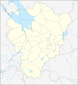
| Location of Burmakino | |
  | |
| Coordinates: 57°24′53″N 40°14′06″E / 57.4148°N 40.2351°E / 57.4148; 40.2351 | |
| Country | Russia |
| Federal subject | Yaroslavl Oblast |
| Administrative district | Nekrasovsky District |
| Elevation | 130 m (430 ft) |
| Population | |
| • Total | 2,945 |
| • Estimate | 2,368 (−19.6%) |
| Time zone | UTC+3 (MSK |
| Postal code(s) | 152290, 152291, 152295 |
| OKTMO ID | 78626409051 |
Burmakino (Russian: Бурма́кино) is an urban locality (an urban-type settlement) in Nekrasovsky District of Yaroslavl Oblast, Russia. Population: 2,945 (2010 Census); 3,389 (2002 Census); 3,800 (1989 Soviet census).
References
-
Error: Unable to display the reference from Wikidata properly. Technical details:
- Reason for the failure of {{Cite web}}: The Wikidata reference contains the property GeoNames ID (P1566), which is not assigned to any parameter of this template.
- Reason for the failure of {{Cite Q}}: The Wikidata reference contains the property publisher (P123), which is not assigned to any parameter of this template.
- ^ Russian Federal State Statistics Service (2011). Всероссийская перепись населения 2010 года. Том 1 [2010 All-Russian Population Census, vol. 1]. Всероссийская перепись населения 2010 года (in Russian). Federal State Statistics Service.
- "26. Численность постоянного населения Российской Федерации по муниципальным образованиям на 1 января 2018 года". Federal State Statistics Service. Retrieved January 23, 2019.
- "Об исчислении времени". Официальный интернет-портал правовой информации (in Russian). June 3, 2011. Retrieved January 19, 2019.
- Почта России. Информационно-вычислительный центр ОАСУ РПО. (Russian Post). Поиск объектов почтовой связи (Postal Objects Search) (in Russian)
- Federal State Statistics Service (May 21, 2004). Численность населения России, субъектов Российской Федерации в составе федеральных округов, районов, городских поселений, сельских населённых пунктов – районных центров и сельских населённых пунктов с населением 3 тысячи и более человек [Population of Russia, Its Federal Districts, Federal Subjects, Districts, Urban Localities, Rural Localities—Administrative Centers, and Rural Localities with Population of Over 3,000] (XLS). Всероссийская перепись населения 2002 года (in Russian).
- Всесоюзная перепись населения 1989 г. Численность наличного населения союзных и автономных республик, автономных областей и округов, краёв, областей, районов, городских поселений и сёл-райцентров [All Union Population Census of 1989: Present Population of Union and Autonomous Republics, Autonomous Oblasts and Okrugs, Krais, Oblasts, Districts, Urban Settlements, and Villages Serving as District Administrative Centers]. Всесоюзная перепись населения 1989 года (in Russian). Институт демографии Национального исследовательского университета: Высшая школа экономики . 1989 – via Demoscope Weekly.
| Administrative divisions of Yaroslavl Oblast | |
|---|---|
| Administrative center: Yaroslavl • Rural localities | |
| Districts | |
| Cities and towns | |
| Urban-type settlements | |
This Yaroslavl Oblast location article is a stub. You can help Misplaced Pages by expanding it. |