| Burrell Boom | |
|---|---|
 | |
| Coordinates: 17°34′00″N 88°24′00″W / 17.56667°N 88.40000°W / 17.56667; -88.40000 | |
| Country | |
| District | Belize District |
| Constituency | Belize Rural North |
| Climate | Am |
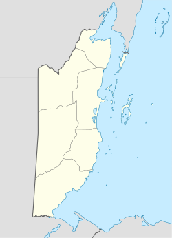
Burrell Boom is on the Belize River twenty miles above Belize City, Belize. Tourists pass through this historic village on their way to the Community Baboon Sanctuary, where the population of black howler monkeys has grown to over 2,000.
Demographics
At the time of the 2010 census, Burrell Boom had a population of 2,218. Of these, 50.8% were Creole, 25.2% Mestizo, 15.2% Mixed, 2.6% East Indian, 1.3% African, 1.3% Caucasian, 1.0% Garifuna, 0.8% Asian, 0.4% Ketchi Maya, 0.3% Mennonite, 0.1% Yucatec Maya and 0.1% others.
History


During the 18th century, loggers settled along the Belize River, floating logwood and later mahogany logs down to Belize Town. Burrell Boom grew as a gathering and milling point for these logs, with its boom stretched across the river.
In 1837 the Methodist ministers Thomas Jefferies and John Greenwood built a chapel in Burrell Boom, and Catholic missionary activities ensued along the whole Belize River from the mid-nineteenth century. The village has now both Methodist and Catholic elementary schools. Each Good Friday Anglican, Methodist, and Catholic communities in town gather for an ecumenical service which rotates among the churches. A number of refugees from neighboring republics have settled near the town and drawn Jehovah's Witnesses on mission to the area.
After 2000 the link between the Northern and Western highways was improved, passing near to Burrell Boom and bringing the village greater prominence.
Climate
Burrell Boom has a tropical monsoon climate.
| Climate data for Burrell Boom | |||||||||||||
|---|---|---|---|---|---|---|---|---|---|---|---|---|---|
| Month | Jan | Feb | Mar | Apr | May | Jun | Jul | Aug | Sep | Oct | Nov | Dec | Year |
| Daily mean °C (°F) | 22.6 (72.7) |
23.6 (74.5) |
24.4 (75.9) |
26.2 (79.2) |
27.0 (80.6) |
27.0 (80.6) |
26.5 (79.7) |
26.3 (79.3) |
26.6 (79.9) |
25.8 (78.4) |
23.8 (74.8) |
23.1 (73.6) |
25.2 (77.4) |
| Average precipitation mm (inches) | 119 (4.7) |
65 (2.6) |
55 (2.2) |
47 (1.9) |
112 (4.4) |
297 (11.7) |
249 (9.8) |
204 (8.0) |
275 (10.8) |
262 (10.3) |
191 (7.5) |
157 (6.2) |
2,033 (80.1) |
| Source: Climate-Data.org | |||||||||||||
References
- "Baboon Sanctuary". Archived from the original on June 20, 2015. Retrieved June 19, 2015.
{{cite web}}: CS1 maint: unfit URL (link) - Population & Housing Census 2010
- ^ Woods, Charles M. Sr.; et al. (2015). Years of Grace: The History of Roman Catholic Evangelization in Belize: 1524-2014. Belize City: Roman Catholic Diocese of Belize City-Belmopan.
- Johnson, W.R. (1985). A history of Christianity in Belize: 1776-1838. Lanham, MD: University Press of America.
- Hopkins, F. (October 1918), "The Catholic Church in British Honduras (1851-1918)", Catholic Historical Review, 4 (3): 1–11, 304–314, JSTOR 25011583
- "Climate: Burrell Boom". Climate-Data.org. Retrieved 12 April 2014.
17°34′N 88°24′W / 17.567°N 88.400°W / 17.567; -88.400
This article about the geography of Belize is a stub. You can help Misplaced Pages by expanding it. |