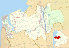
Human settlement in England
| Cabus | |
|---|---|
 The Hamilton Arms, on the A6, Cabus The Hamilton Arms, on the A6, Cabus | |
  | |
| Population | 1,522 (2011) |
| OS grid reference | SD489472 |
| Civil parish |
|
| District | |
| Shire county | |
| Region | |
| Country | England |
| Sovereign state | United Kingdom |
| Post town | Preston |
| Postcode district | PR3 |
| Dialling code | 01995 |
| Police | Lancashire |
| Fire | Lancashire |
| Ambulance | North West |
| UK Parliament | |
| |
Cabus is a village and civil parish in Lancashire, England. It lies 12 miles north of Preston, 9 miles south of Lancaster and 16 miles north east of Blackpool.
The electoral ward of Cabus, which includes some northern suburbs of Garstang and a rural area around the village, had a population of 1,573 in 2001 and lies in the Wyre district. The population of the parish was 1,522 at the 2011 Census.
See also
References
- "Local statistics - Office for National Statistics". neighbourhood.statistics.gov.uk. Retrieved 19 March 2018.
- UK Census (2011). "Local Area Report – Cabus Parish (E04005323)". Nomis. Office for National Statistics. Retrieved 27 March 2021.
External links
![]() Media related to Cabus at Wikimedia Commons
Media related to Cabus at Wikimedia Commons
| Geography of the Borough of Wyre | |||||||
|---|---|---|---|---|---|---|---|
| Towns | |||||||
| Villages |
| ||||||
| Parishes | |||||||
| Topography |
| ||||||
This Lancashire location article is a stub. You can help Misplaced Pages by expanding it. |