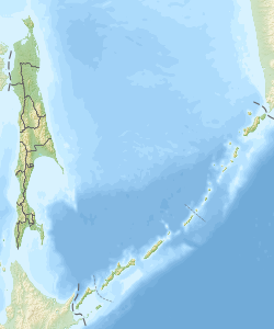
| Cape Elizabeth
Russian: Мыс Елизаветы Japanese: 鵞小門岬 | |
|---|---|
| Cape | |
 | |
| Coordinates: 54°42′22″N 142°42′21.75″E / 54.70611°N 142.7060417°E / 54.70611; 142.7060417 | |
| Location | Schmidt Peninsula Sakhalin Oblast, Russia |
| Offshore water bodies | Sea of Okhotsk |
| Area | |
| • Total | Russian Far East |
| Elevation | 539 m (1,768 ft) |
Cape Elizabeth (Russian: Мыс Елизаветы, Japanese: 鵞小門岬 "Gaoto-misaki") is a cape on the Schmidt Peninsula. It is the northernmost point of Sakhalin.
Cape Elizabeth was named by Adam Johann von Krusenstern (aka Ivan Kruzenstern) in 1805 after Empress Elizaveta, wife of Alexander I of Russia.
The cape is a territory under administration of the Okhinsky District and was even considered the northernmost point of Japan until the Treaty of Saint Petersburg in 1875 when it was replaced by the northernmost point of Atlasov Island (known in Japanese as Araido (阿頼度) and in Ainu as Oyakoba).
History
Between 1848 and 1874, American whaleships caught bowhead whales off the cape. They also went ashore to obtain wood.
See also
References
- Mary and Susan, of Stonington, Aug. 26, 31, Sep. 9, 1848, Nicholson Whaling Collection; Sea Breeze, of New Bedford, July 8, 1874, G. W. Blunt White Library.
- Navy, of New Bedford, Sep. 19, 1861, Kendall Whaling Museum.
External links
- Sakhalin Lighthouses (Маяки Сахалина) Archived 2018-03-21 at the Wayback Machine (in Russian)
This Sakhalin Oblast location article is a stub. You can help Misplaced Pages by expanding it. |