| Cape Noshappu 野寒布岬(ノシャップ岬) | |
|---|---|
| Cape | |
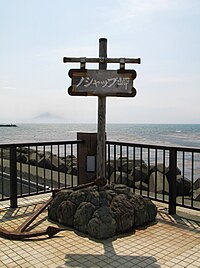
 Cape Noshappu Monument Cape Noshappu Monument | |
  | |
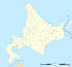
| Coordinates: 45°26′59″N 141°38′43″E / 45.4496°N 141.6453°E / 45.4496; 141.6453 | |
| Location | Wakkanai, Sōya Subprefecture, Hokkaido, Japan |
| Offshore water bodies | Sea of Japan |
Cape Noshappu (野寒布岬 / Noshappu-misaki) is a cape near Cape Sōya in the north of Hokkaido island, Japan and located in Wakkanai, Sōya Subprefecture. Facing Sōya strait, it separates Sea of Japan and Sōya Bay. In etymology, the name origins from "ノッサㇺ(not-sam)" in Ainu language. Wakkanai Lighthouse is located approaching the cape, and Rishiri Island and Rebun Island are visible when clear. Esandomari Fishing Port Park (恵山泊漁港公園) lies in southwest of the cape and Wakkanai Municipal Noshappu Current Aquarium (稚内市立ノシャップ寒流水族館) is nearby.
Gallery
-
 Rishiri Fuji seen from noshappu-cape
-
Noshappu Cape in early summer
-
in Esandomari Fishing Port Park
-
 the cape in Aug 2010
References
- 山田秀三 (2018-11-30). 北海道の地名. アイヌ語地名の研究 山田秀三著作集 別巻 (in Japanese) (2 ed.). 浦安市: 草風館. p. 160. ISBN 978-4-88323-114-0.
- "ノシャップ岬". 稚内市.